Tuesday, 5 March 2019

The New Normal

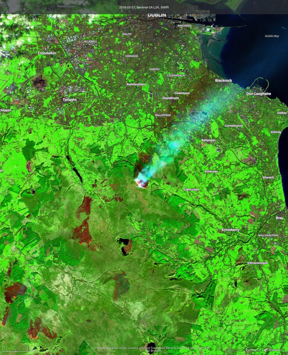
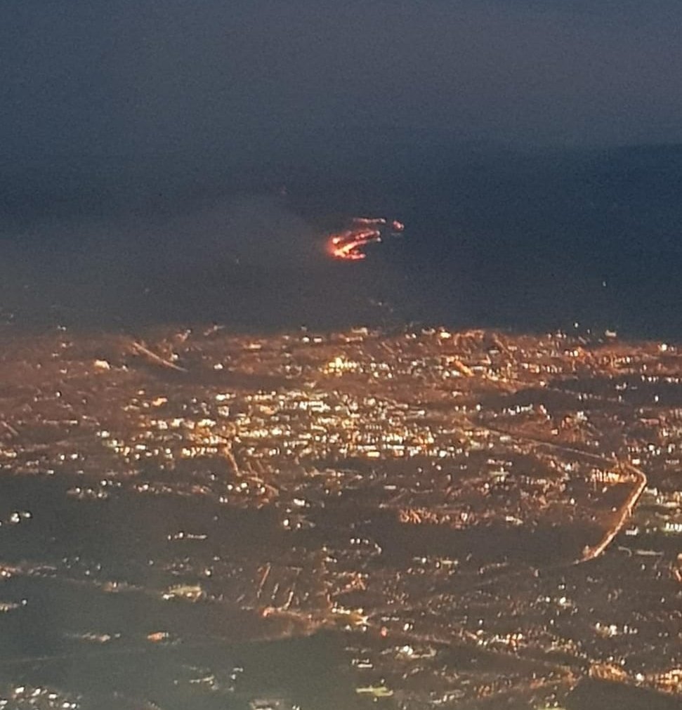
Copernicus are doing a series of posts on Twitter entitled 'the new normal?'. Images of wildfires in the middle of winter - often only a few kilometres from snow. These images were on the Dublin Fire Brigade twitter page at the weekend of the fires in the Dublin mountains. One day later the whole county was covered in snow. The whole country is still way behind on groundwater levels, see Teagasc's latest map of the month for satellite derived measurements of soil moisture. Measured via MODIS at 1km spatial resolution, you can see how bad 2018 was for crops.

SWIR Image from Sentinel 2 - Copernicus Imagery

Image taken out window of plane leaving Dublin Airport - Dublin Fire Brigade Twitter

 It is the same all over Europe at present - Croatia, Romania, Spain, Bosnia-Herzegovina - have a look at the Copernicus Twitter Page

Tuesday, 26 February 2019

#Technologyweek on Twitter

Make sure to take a look at some of the twitter posts in the sidebar - I'm giving a few updates for #Technologyweek for #YearofGeography.

Friday, 22 February 2019

Story Telling From Space

I came across an excellent intro on satellite imagery on twitter during the week -  but what really caught my attention was some of the supports dedicated to journalists, like 'Satellite Journalism - the big picture' - a paper showcasing loads of examples of EU data used in investigations around the world, this has so many examples from a quick skim I gave it this morning that it is a must read.


Image from 'Satellite Journalism - the Big picture'


Another interesting resource - Earth Rise Media is an EO company that aims to help journalists with 'story telling from space'. tons of good stuff in these different links - need time to go through it properly and I want to have a proper read of the satellite journalism one.


Friday, 15 February 2019

Free (LiDAR) Datsets

I came across a great resource recently and have directed the MSc GIS/RS students to it for their next assignment. OpenTopography is a huge repository of freely available topographic data (raster and vector) but of particular interest to the GIS/RS students is the point cloud data that they are using for their LiDAR assignment. 

I counted 271 aerial LiDAR datasets, 8 terrestrial laser scanner datasets and 4 photogrammetrically-derived point clouds. I was impressed not only by the volume but also the variety, with point clouds of everything ranging from volcanoes to landslides to urban centres. It is a simple drag and drop selection and download interface and you don't even need to register for the smaller files. It will also provide partial processing for you in the download options! Data is largely concentrated in USA but I spotted data for New Zealand, Spain and other locations.


My only complaint so far is that when you are selecting data for one of the change detection studies (very helpfully flagged as such in the listing) you do not know where in the test site the change occurred - but the dataset is too large to download it all and find out, so you are kind of snookered! Note: I googled for a nice image to show snookered but there was none, what's up with that?



Friday, 8 February 2019

GIS in Schools

Some big news for geography (and geo in general) just before Christmas. ESRI - the largest supplier of GIS software in the world (and founded by the man with the excellent name - Jack Dangermond) has recently announced nearly half a billion euro worth of GIS and mapping software for primary and secondary schools around the country. Almost a million students, in 4,000 schools will all have free access to AGOL. This all feeds into the digital strategy action plan - launched in June by Minister Bruton and will be a huge benefit to students. There was one map on the wall of the geography class in my school - that was it.


Its a shame with this type of investment going into the schools that Geography is not still a compulsory subject at junior level.

Congrats to all involved in the initiative - I have heard a few familiar names come up in conversation.

Thursday, 17 January 2019

Worldview 4- Gyroscope Failure

Looks like it may be curtains for the satellite providing the highest image resolution currently available on the market. At 0.31m (max spatial resolution permissible for commercial sale under US law - no idea what it was technically capable of) World view 4's panchromatic band was the crispest image you could get from space to the best of my knowledge. I have never used any WV4 data - but having used the Pleiades 0.5m panchromatic images - you could see road markings, cars, the whole area in incredible detail so can only imagine how good it was almost x2 better. 


Space.com and others reported WV4 has experience a gyroscope malfunction - which will stop it from pointing properly. These VHR (very high resolution) satellites were critically dependant on pointing capabilities, as with the longer FOV required to enable a hi-res image capture, the image footprint was reduced correspondingly. Targets of opportunity and localized areas in high detail were their specialty.

Interesting figures given on return of investment for WV4 - net book value is €155 million (i assume that means to build and launch - possibly maintain and process data), but the returns were approximately €85m in 2018 alone. Having launched in Nov 2016 - had it paid for itself yet? Possibly.

Digital Globe plan to continue efforts to restore it - but they expect those efforts to be unsuccessful.


Monday, 14 January 2019

2018 - A year in review

A bit late doing this update - but another interesting one in 2018..

  • One blizzard
  • One heat wave
  • One drought
  • One MSc accredited
  • One paper
  • 2 jobs
  • 10 modules
  • 3 conferences

Roll on 2019!

About Me

My photo
My name is Conor. I am a Lecturer at the Department of Geography at Maynooth University. These few lines will (hopefully) chart my progress through academia and the world of research.