Not a bad year at all - some good luck with funding applications, three papers published, lectures on two modules finished and joined a new professional body - all wrapped off with a KFM talk on how Santa finds your house.
I love Christmas.
Roll on 2016.
Wednesday, 23 December 2015
Thursday, 17 December 2015
Flood Maps and Copernicus Emergency Services
I normally try and limit myself to 4 or 5 posts a month so I don't use all the content up, but with a week still to go until the Christmas break, so much is happening right now that I can't save it all until the new year. Drone regulation updates, Innovation 2020, an updated Marine Mapping Atlas - but undoubtedly the top story of the month is the severe flooding around the countryside, and particularly near Limerick (Parteen Weir). It is good to see the Copernicus Emergency Services in action and providing tangible benefits to the Irish taxpayer as it is their money that goes into ESA.

These images are generally pre-event optical used as a reference and post-event SAR highlighting the extent flooding, either Sentinel 1a, or Terra-SAR X among others. Unsurprisingly in periods of bad weather, the view from optical satellites such as Sentinel 2a is obscured by cloud throughout the whole event - so the weather independent benefits of SAR are highlighted once again. Almost daily reports from Copernicus Emergency Services are available once the service is activated, providing response teams and other organisations with updated info. Here is an example.

A valuable resource.
Monday, 14 December 2015
Paper Published on Satellite Prediction
I am very pleased that this paper was just published.

Combining 2D Mapping and Low Density Elevation Data in a GIS for GNSS Shadow Prediction.
I designed a method for using OSi vector data and some basic elevation data, in conjunction with satellite prediction software and a GIS to plan mobile GNSS surveys. 'Mobile' had been in the original title but it came out during the review process. I tested it around the campus and it performed really well - even without vegetation.

The main reason I am pleased is that it is my first paper as sole author (ERC here I come - I finally have the paper requirement), but also because it took alot of effort to get published and I am glad to have it over the finish line. I submitted this paper on Christmas Eve 2014 to get it in before the closing of the final, 'free of charge' window from the ISPRS open acess journal. It went through alot of reviews:
- 3 reviewers x 2 rounds (major revisions)
- 1 external editor
- Finally the internal editor
But unfortunately the eventual decision was, 'reject and resubmit'. I did so, and then it went through
4. another 2 reviewers with (minor revisions)
5. The internal editor
and I finally had it published last week. It's also my first appearance in a paper - that is my back in Figure 1a doing elevations for a flood survey and planning appeal in Skibbereen. The staff at the paper are very professional are very thorough, I think IJGI will be very popular. Will it overtake the print ISPRS journal?
Thursday, 10 December 2015
Sciencists.
I was the lucky recipient of a spare iCrag ticket and got to attend SciCom:2015 yesterday in Athlone. It was aimed at enhancing science communication and making scientists more aware of the challenges they face in getting their message across and increasing their profile. It was a very enjoyable conference and certainly made a welcome change from the, 'death by powerpoint' formula of the academic conferences that I usually attend.

An excellent range of speakers and the keynote was extremely entertaining - Quentin Cooper from BBC's, 'The Forum'. Some excellent facts from his talk:
- Really we should be, 'Sciencists' to spell it correctly, but when coining the term, 'Scientist' in the early 1800's the term for the cluster of enthusiasts was modelled on the term for defining a broad range of, 'Artists' - and so the 'T' stuck.
- When dealing with barriers to improving people's perceptions of sciencists - the top 3 screen sciencists aren't even human. Spock was one of the them.

- Sciencists are statistically guaranteed to be the most likely character killed on television. Sciencists have a 10% chance of being killed. That is strange - as it was usually the guys in red who bought it in Star Trek - not Spock.

- We are also evil - as there is a 5% chance that the baddy in a movie will be a sciencist.
Some great talks, and easily the most stable Skype connection that I have ever seen for a webcast with Connie St. Louis.
Monday, 7 December 2015
Sentinel 2a
Public access to early Sentinel 2a data was announced last week. Europe and Africa are being imaged every orbit during the ramp-up stage, with the rest of the world at a 30 day cycle. Here it is right now on an ascending pass in the Indian ocean. Also a neat little ESA app if anyone would like to track it in real-time or learn more about it.


Saturday, 5 December 2015
Mount Etna
Here is a beautiful Landsat 8 RGB composite of Mount Etna smoking, 3rd December 2015. The full eruption happened later in the day and I suppose the cloud would have covered anyway. Unfortunately Landsat 8's thermal bands malfunctioned back in November so we can't get a thermal comparison from this image. There are also quite a few algal blooms around Sicily at present.

Just look at the colours in this image, what a beautiful planet.
Friday, 4 December 2015
iCrag Launch
One of the new projects I will be working on is, "slick feature mapping" with iCrag which will involve locating, measuring and monitoring natural and man-made slick features. iCrag is one of the new SFI centres and represents a massive boost to the geoscience community. Tim, Daire and myself will all be involved for the next year + on this project. We were invited to the iCrag launch in UCD on wednesday - an excellent turn out. It was also good to meet some of the names I had heard mentioned over the preceeding months too. Looking forward to the project!
Tuesday, 1 December 2015
FLEX
'FLEX' was a regular topic of conversation during the POLWET survey in the summer. This was one of the final candidates for ESA's 8th earth explorer mission and there were high hopes that it would be selected. FLEX is designed to measure fluorescence worldwide and therefore would obviously be of key interest to OPTIMISE. Fluorescence can give an idea of how well a plant is photosynthesising, so if you can successfully measure fluorescence then you can locate crops under stress almost immediately, rather than waiting for colour changes using the traditional NDVI route when in some cases the damage is already done.

FLEX's successful selection as the 8th earth explorer mission was announced some time ago but a recent post on ESA's LinkedIn page has some good info and images, such as the one I have used here.
Launch in 2022.
Monday, 30 November 2015
SCS Merger Finalised
The merger of the IIS and the SCSI is now complete. After a few kick-off meetings and the members meet last week things are starting to get moving again, great to see. A recent article in Irish Construction Magazine announcing it to a wider audience.

I'll be pushing ahead with the transfer of the old IIS Remote Sensing Working Group, anyone interested in helping just email/post here. First thing on the agenda will be looking at getting some of the bigger University RS and GIS modules accredited - the graduates of these all end up working in Geomatics, but don't have a proper home as of yet.
Time to remedy that.
Thursday, 19 November 2015
Colour: The Spectrum of Science
There is an excellent programme on BBC4 of late, Wednesday evenings - very clearly illustrating the science of the EM spectrum, how we evolved to see various colours, etc.

The presenter gives a very clear explanation of exactly how vegetation reacts with the visible portion of the spectrum here at about 9mins to 11mins in, should be shown to all RS students.
The presenter gives a very clear explanation of exactly how vegetation reacts with the visible portion of the spectrum here at about 9mins to 11mins in, should be shown to all RS students.
Tuesday, 17 November 2015
Bathymetry Paper Published
Another one up on the board! We had a paper entitled, "Spatial Prediction of Coastal Bathymetry Based on Multispectral Satellite Imagery and Multibeam Data" published in Remote Sensing a few weeks ago. The test area was Dublin bay. If you can get sediment free conditions in a satellite image then satellite bathymetry really is an exciting solution and we used spatial regression algorithms to improve the accuracy of the satellite derived bathymetric surface model.

This paper was a collaboration between Xavier Monteys from the GSI, Paul Harris (ex StratAG) and Silvia Caloca from ICARUS and it was the study that provided the incentive to follow up with the SFI Industry Fellowship with TechWorks Marine in 2013. Some excellent plot libraries in R and my co-authors were very familiar with them - I can honestly say it is the best looking paper I have been an author on yet.
Thursday, 12 November 2015
Pyramids
No, not the type you are regularly hounded into, 'drawing' in most RS packages.
Quite a few references to the pyramids in the news recently but I was interested to see all the hardware they are applying to the latest round of surveys - thermal and LiDAR amongst them. I had no idea what a, 'muon' was. Also considering the latest news wouldn't it be ironic/funny (and add quite alot of fuel to the fire) if it was old stores of fermenting grain!!
Quite a few references to the pyramids in the news recently but I was interested to see all the hardware they are applying to the latest round of surveys - thermal and LiDAR amongst them. I had no idea what a, 'muon' was. Also considering the latest news wouldn't it be ironic/funny (and add quite alot of fuel to the fire) if it was old stores of fermenting grain!!
Monday, 9 November 2015
Drones, Data X Conference - Westport
Maynooth and the NCG had a presence at the Drones, Data X Conference in Westport last Friday.
We had one of the exhibitor booths and both Tim McCarthy and myself went over for the Friday session with the Falcon, Bramor, some display monitors and 4 pop-up stands. After a (very) early start and long, dark drive with nothing but Marty Whelan for company we were set-up ready for the first attendees by 8am.

We were kept busy for most of the rest of the day by attendees asking questions about uses of drones at the University, the sensor hardware or interested in forming links. Lots of very interesting questions - such a wide range of applications being developed. I can honestly say I have never answered so many questions about our work, it is amazing the difference having the stand made when compared to the usual, 'coffee and danish' conversations in a tight corner of a room while trying not to get food on your face/in your teeth. Maybe something to consider for again. Oddly, we were the only drone operator in the room with a fixed-wing - VTOLs were predominant.

Lots of other interesting exhibitors there: videographers, GNSS receiver manufacturers, drone retailers, drone insurance, training, tourism, 3D Printing ( I told them my tale of woe about my shipwreck adventure, turns out they had done it properly with a DEM of the Lusitania). The usual 'its a small world' of Geomatics theme popped up, as I was sitting having a sandwich and soup with a good friend's cousin.
My regrets from the day are:
1. Not getting a chance to attend any of the talks - I was kept busy at the stand.
2. Not wangling one of the lovely 2016 drone photography calendars from iFly.
3. Not leaving an angry note on the dash of the person who parked me in delaying me from starting the long trip home - that is you silver Citroen!
It ran for two more days I think and I also did my bit for the Mayo tourist board, giving two Americans over from Nevada the hard-sell on the Westport Greenway and the cycle to Achill.
Thursday, 22 October 2015
IEOS 2015
A good day and a good turn-out at the IEOS yesterday in NUIG hosted by the Ryan Institute. A lovely campus, my first time there.
Our group was presenting, "Sensor Pods and Sensor Fusion; Initial Results from an Aerial Survey". We had combined a Nikon D800 SLR with a Zeiss lens, a Tau 640 Thermal, a Agrosensor Multispectral and a HD video camera in a sensor pod and used it for a number of different study areas in a single flight. Here is a snapshot of one of my slides -FCC, thermal and RGB of Knowth, an impressive passage tomb in Meath. I had originally thought it was Newgrange, which would have been a great claim to make as considering how much time I usually spend waffling about accuracies that would mean this system was off by about +/- 1,200 meters..

No questions from the audience afterwards - does that mean
a) they were lost
b) i explained everything so well nothing further was needed...
Ignorance is bliss, I don't need to know.
An excellent keynote speech covering SAR too and tipped me off on a few good sources for an upcoming iCrag project.
Monday, 19 October 2015
Planting Trees with Drones
This sounds like a great idea to combat deforestation. 26 billion trees cut down each year and only 15 billion replanted? The drone can be tasked to drop seeds in areas where no trees are currently growing (possibly using satellite imagery to pinpoint these locations?) and each seed will be coated in a nutrient rich gel to encourage rapid growth.
A really clever, positive use of drones.
Hopefully birds wont catch on that these flying seed dispensers exist or we'll see similar scenes to this as UAVs cross our skies.

A really clever, positive use of drones.
Hopefully birds wont catch on that these flying seed dispensers exist or we'll see similar scenes to this as UAVs cross our skies.

Monday, 12 October 2015
Sentinel 1a and 2a
ESA released two nice pics in their media section showing results from Sentinel 1a and Sentinel 2a for monitoring ship traffic on the Romanian portion of the Danube. You can blame any geometric distortions on sensor calibration issues or on my shoddy cut and paste....its up to the reader to decide.
 |
| S1a |
 |
| S2a |
Friday, 9 October 2015
Collision proof
Following on from the last post of interesting drone designs - this new, collision proof idea from flyability, 'Gimbal' looks interesting. The drone is housed on a gimbal allowing 3 degrees of freedom so the propeller always stays upright while the case protects it.

Videos provided at the link.

Videos provided at the link.
Wednesday, 30 September 2015
Fungus drone
An interesting idea, 'bio-degradable' drones. This one has been constructed from a fungus in a mould lab! Seems to be partially designed to reduce carbon footprint, but also so an intelligence drone will degrade if it crashes and leave no trace.

Great closing line from the author,
"Trying to reduce our footprint on the environment is great, but methinks that a puddle of fungal goop with propellers sticking out of it might still be a giveaway that someone's been spying."

Great closing line from the author,
"Trying to reduce our footprint on the environment is great, but methinks that a puddle of fungal goop with propellers sticking out of it might still be a giveaway that someone's been spying."
Monday, 14 September 2015
Sunday Business Post
Lots of pics taken of the whole team but we were cropped out. Probably best as we all were wearing identical shirts....Good to see Tim and the team getting the exposure though. interesting choice of cropping in this photo too - the black drone in-shot costs about €1k whereas the barely visible orange, Bramor costs tens of €thousands and looks way cooler.
Drone research takes off at Maynooth
03:55, 13 September 2015 by Margaret O'Brien
Thursday, 10 September 2015
Duct Tape
There is a great line in Gran Torino where Clint Eastwood explains the relevance of Duct Tape for almost everything. Well duct tape plays a large role in R&D too. Here it is on the XP1 forming the outside cover of an early-stage sensor pod, keeping the cables under control in the interior, holding a GPS receiver to the dash, and helping route cables through doors with minimum damage. We considered 3D printing the mounts but my experiences with the 3D printer in Maynooth University library scuppered that.

This is the Experimental Platform 1 (XP1), our Mobile Mapping System (MMS). Most of my academic journal papers up until now have covered this in some shape or form and my PhD thesis related to creating a method for system performance assessment. Don't let the duct tape fool you - it is just there for expediency. There is some serious kit on the XP1:
1. An IXSEA LandINS on the back provides navigation info through periods of GNSS outage and allows you to record and georeference data captured in tunnels. We were working in the Dublin Port Tunnel yesterday, traffic was delayed - if you were delayed, then blame us :) But it is for your safety, and to improve that.
2. Beside the IXSEA is a GNSS receiver.
3. At the rear right wheel is a Distance Measurement Unit (DMI). This is a survey grade odometer which can be used to help control drift in the INS. The Zero Velocity Updates (ZUPTS) that this provides tell the INS when the vehicle is at a complete halt. Any movement it is measuring is therefore drift and can be compensated for.
4. The Duct Tape box at the front right is an Agrosensor, a multispectral camera recording in G,R and 2x NIR.
5. The front middle sensor is a cheapo Go-Pro for recording video.
6. The front left sensor is a thermal camera.
7. There is also a roadhawk inside the front window.
The Riegl VQ-250, a 2D laser scanner capable of 300,000 measurements each second was not used in this survey. It usually sits up beside the IXSEA and GNSS antenna. I've been working with satellite and drone imagery so much over the last three years that I have not been helping out as much with the MMS surveys. Good to see it again.
Wednesday, 2 September 2015
Relativity and GNSS Satellites.
I saw 'Interstellar' a few months back in the IMax. Excellent film.
There is a scene in it (spoiler alert) where the shuttle arrives at a planet that is orbiting a dwarf star, or some such object that exhibits a massive gravitational pull. The crew debate and briefly explain the issue of relativity before going down to the surface. Time passes more slowly depending on gravity, and this is dependant on your proximity to the body exhibiting the gravititational pull. During the 15 minutes spent by the four crew on the planet surface the single crew member left on the shuttle in orbit will experience about 1 year and have aged accordingly. To cut a long story short, the crew that go down to the planet run into trouble, get knocked around by a few waves and barely get away with their lives.

Understandably this has delayed them slightly and when they get up to the ship the guy who was left has aged by about 20 years. See, he has a beard.

The maths behind this is beyond me but the principle was pretty easy to follow during the movie. I was left very entertained and thinking how it will never effect me, right? Obviously I'm unlikely to be orbiting a massive star or part of a planetary exploration mission anytime soon.
Wrong.
I came across a very real surveying example only a few weeks after seeing the movie. GNSS satellites must be able to tell their time to extremely high tolerances and there are atomic clocks on board each satellite for this very reason. However, due to the proximity to the body emitting the larger gravitation pull, 1 second recorded by the clock on earth is slower than 1 second recorded by the clock on a satellite. Added to this, the direction the satellite orbits around the large body exhibiting the gravitational pull can also add or subtract to the effect. The bottom line is that the two clocks will diverge by 38 microseconds per day and this has to be built into the satellite clock when calibrating it before launch!
More info here and here for anyone interested.
More info here and here for anyone interested.
Thursday, 20 August 2015
Leica Photogrammetry Suite - a.k.a. - Imagine Photgrammetry
ERDAS Imagine now has Leica Photogrammetry Suite incorporated. It has been rebranded as, "Imagine Photogrammetry" or so I understand. This may also have done the job for calculating distortion coefficients that I mentioned in my previous post but I did not get around to exploring it properly. I would like to experiment with satellite stereo imaging, like SPOT, Pleiades, etc. I may also use it to validate the results from OpenCV and it vould be a potential low cost option for creating orthomosaics with UAS imagery, as we already have an ERDAS licence at the University.

An alternative option is VisualSFM, a different software package I am looking at after a reccomendation from a UAV operator last week- but that will be a post for another day.
Wednesday, 19 August 2015
Camera calibration and distortion coefficients
Some cameras you might get and would like to use for photogrammetry come with all the required info in manuals, metafiles or have already been calibrated by someone else. But what happens if you are missing something? Focal length, etc is relatively easy to get but the lens distortions (radial, tangential) are not. We had an aerial survey coming up and needed to get a camera calibrated ASAP. When you search online expect to get out of your depth rapidly in matrices and formulae. But then if you are lucky you might stumble on OpenCV.
OpenCV is an open source computer vision and machine learning library which has what you need to calculate the distortion coefficients. As usual the most complicated thing is getting the software to install, run or compile so I ended up pulling what I needed out and running it in Python separately. In theory it seems to work and finally I have a legitimate reason for having a chessboard up on my monitor. It also means I can start trying to find the other values I need for the camera.

Edit: That is not me, my office or my computer!
Friday, 14 August 2015
Flight mode
We have recently acquired a 3DR Solo - a 'use out of the box' class of UAV. It is very stable and manoeuvrable. Additionally, you just need to attach your phone to the controller and it becomes your video display for piloting the platform so that cuts down on hardware costs.

I heard a funny story today from someone who had been piloting a similar UAV at the max line-of-sight range and therefore completely reliant on this video link, when suddenly their wife rings in and the video link switches to the 'incoming call' screen. One to watch out for....
Setting the phone to 'flight mode' would solve the problem but that is definitely not the 'flight mode' they had in mind when building those features into phones!
Monday, 10 August 2015
Dublin Bay - Landsat 8
After I posted recently about the Dublin Bay biosphere I thought I should follow up with a quick post on using remote sensing for the same area. Here is a beautiful Landsat 8 image of Dublin Bay and the oceanic processes in the area are easy to see. I'm no oceanographer or marine biologist and so I have no idea if it is sediment, algae, plankton or a combination of all 3 but it certainly looks nice. Unfortunately the problem is that I'm trying to find an image where this is minimised and I have gone back as far as 2013 (which is around when L8 started provided imagery from) and it is evident in all of them.

Thursday, 6 August 2015
It's mine!!
I'm not convinced that having the, 'claim authorship' button beside the 'download publication' button is such a good idea....Good job RG design team.


Tuesday, 4 August 2015
Dublin Bay - UNESCO Biosphere
A UNESCO Biosophere designation has been extended to cover the whole of Dublin bay, not just the Bull Island - approximately 300 square kilometres. The announcement is available here at the RTE website. Having gone to school just up the road from here and spent lots of my childhood visiting grandparents beside the Bull Wall, I am very glad to hear it is being taken care of.

I was originally not sure what spatial extents they have assigned to the Biosphere - some of the imagery seems to imply that its limits were the entrance to the Liffey, south to Dun Laoghaire Harbour and North to the Bull Island, but certainly the Lord Mayor makes reference to Malahide as well in a number of press releases. I found a better map online that defines it fully.

It seems to have three zones, but four colours? It could just be the transparent yellow layer clashing with the underlying blue sea layer in the GIS. The core zone covers the inner bay and entrance to the Liffey, the coast at Howth and the wetlands/shore at Donabate. All beautiful areas that I have spent plenty of time over the years. It does not seem to extend North past Portmarnock so I do not think Malahide or the entrance to the Broadmeadow estuary is included.
The Dublin coast is particularly relevant to a number of projects I have been involved with:
The Dublin coast is particularly relevant to a number of projects I have been involved with:
- I worked as a surveyor and GIS Analyst in a Dublin County Council for 4 years.
- After I joined the NCG we carried out Mobile Mapping System LiDAR and imagery road surveys in the Port Tunnel and surrounding areas.
- We performed some coastal erosion surveys using UAVs in Portrane in early 2012
- Tested photogrammetric methods to assess UAV accuracy during matching in featureless terrain along the Portmarnock beaches.
- Dublin bay and the Bull Wall was the test bed for the early satellite bathymetry study which lead to the SFI Fellowship.
Looks like there might be many more opportunities for non-invasive, non-contact survey methodologies (i,e. remote sensing and photogrammetry!!) to prove their worth in this area over the coming years.
Monday, 27 July 2015
AutoDesk
I've mentioned this to a few 3D Modellers and builders that I know recently so it is as good a time as any to post. AutoDESK have a great approach to student training - anyone with a college email address (including staff) can get access to almost the whole of the AutoDESK suite for four years.

Not only does that include AutoCAD but also 3DMax (you might remember the 3D model of the Chapel I tried to get printed) or for people working on models and animation for the computer industry you can download MAYA for realistic environments. I wouldn't fancy trying to draw this in AutoCAD!

All available for free here
Wednesday, 22 July 2015
Sentinel 2a imagery
While I am waiting to see if we get any Sentinel 2a imagery from the POLWET survey in Poland, here is a link to a GIM International article with some early data from ESA.

Free, multispectral, 10m spatial resolution imagery will be very welcome to the RS community. May there be many more!

Free, multispectral, 10m spatial resolution imagery will be very welcome to the RS community. May there be many more!
Tuesday, 21 July 2015
POLWET
Just back from 2 weeks in Poland at SWAMP: the 6th EUFAR-OPTIMISE Training Course for spectroscopy in wetlands using aerial, satellite and UAV imagery. OPTIMISE, you might remember is the EU COST Action that I am a part of so this was particularly relevant to me. Here is an orthomosaic of the test-site with some of our sample locations.

I applied for a place on the course and was awarded full funding for the two weeks. From what I hear only 25% of the applicants received places so I was lucky to get one. You might think there would be alot of down-time in a course that long but it was almost non-stop from 9am till 11pm at night, particularly towards the end getting the results finalised.
Lots of great hardware/data collected on the survey -
- At least 4 UAVs, some were really heavy-lifter VTOLs (no fixed wings, they were deemed not steady enough for spectral measurements - quite a few of the things I learned challenged our assumptions and have made me think about the path we are moving down). The Falcon was the man-of-the-match in many cases due the the gimble and its ability to calculate BRDF for the hemisphere above and around a point without obscuring any illumination.
- Two large aerial platforms - a Dornier carrying the 'APEX' sensor and a second aircraft with 'HYPLANT'.
 |
| APEX |
 |
| HYPLANT |
- More field units than you could sneeze at. Here is a nice photo I took of us using an Ocean Optics HR4000 and the Falcon operating in the background.

- A flux tower for eddy-covariance measurements.
- They had even tasked a Sentinel 2a overpass and there is talk of using our field and aerial measurements for calibration.
Lots of hard work but also lots of very interesting people. Some great BBQs, bonfires and beer for less than 1 euro.
I need a holiday!
Tuesday, 30 June 2015
Whales!
I think satellite remote sensing is about as close to seeing whales as I am ever going to get. Another weekend spent waiting for news from the boat captain in Baltimore, West Cork. Cancelled at the last minute due to bad weather. That is the 4th or 5th time it has fallen through I think? I wouldn't mind but today is supposed to be the start of a heat wave!
I'm not giving up though - October is supposed to be the best time of year for whale watching in SW Ireland and I will be back then.
Tuesday, 23 June 2015
Sentinel 2a in orbit
About a year and a half ago I stayed up to watch the launch of Sentinel 1a and make sure it made it safely into orbit (not as if I could influence that much). I have just received an email from GIM International informing that Sentinel 2a has stolen a march on me as I thought the launch was not until tomorrow.

So while I was up watching the first episode of the new series of 'True Detective', Sentinel 2a was entering sun-synchronous orbit without my help. Unlike Sentinel 1a, Sentinel 2a is an optical multispectral satellite and will be very useful in the coming years with a MS resolution comparable with SPOT 4 and 5 (10metres). Up until now the highest spatial resolution, free MS imagery that you could get without applying for it was the 30m bands on the Landsat series.
Watch this space.
Monday, 22 June 2015
Meeting the Challenge of Climate Justice
Mary Robinson just finished her keynote speech at #climatejustice2015. This is the conference I posted the video for a few weeks back.
Pros
Very good speaker and a great sense of humour.
Cons
Very good speaker = minimal elbow room.
Pros
Very good speaker and a great sense of humour.
Cons
Very good speaker = minimal elbow room.
Friday, 12 June 2015
Scale
Someone directed me to a great quote during the week on the subject of scale...
................................
"That's another thing we've learned from your Nation," said Mein Herr, "map-making. But we've carried it much further than you. What do you consider the largest map that would be really useful?"
"About six inches to the mile."
""Only six inches!"exclaimed Mein Herr. "We very soon got to six yards to the mile. Then we tried a hundred yards to the mile. And then came the grandest idea of all! We actually made a map of the country, on the scale of a mile to the mile!"
"Have you used it much?" I enquired.
"It has never been spread out, yet," said Mein Herr: "the farmers objected: they said it would cover the whole country, and shut out the sunlight! So we now use the country itself, as its own map, and I assure you it does nearly as well"
from Lewis Carroll - The Complete Illustrated Works.
Wednesday, 10 June 2015
Scientists can have hobbies too
I posted a while back about completing the release candidate on a software package to send to our distributor. Well the final version was released yesterday and it is getting some great feedback already. As the lead on the QA team I am just happy that it didn't crash everyones PCs.
Don't tell any of my geomatics friends that I am a closet historian...
Don't tell any of my geomatics friends that I am a closet historian...
Tuesday, 2 June 2015
Discovery Programme
I am a big fan of the Discovery Programme. They are always one of the highlights of any remote sensing conference with such beautiful, high quality models. I use their images in my LiDAR lectures and show the students the free to access, online, great collection of 3D models for most of the heritage sites around the country.
Here is a great shot of their Dún Aonghusa model. You can also look at RGB point clouds and pan and zoom as you like.

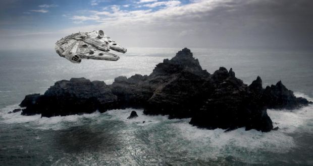
So I was very glad to see the formal launch of their project getting a mention in thejournal.ie a few weeks back. The DP also have some full scans of Skellig Michael, I wonder did they use them for the new Star Wars movie? I know they were filming there.

Here is a great shot of their Dún Aonghusa model. You can also look at RGB point clouds and pan and zoom as you like.

So I was very glad to see the formal launch of their project getting a mention in thejournal.ie a few weeks back. The DP also have some full scans of Skellig Michael, I wonder did they use them for the new Star Wars movie? I know they were filming there.
Wednesday, 20 May 2015
We're doomed. Doomed!
Interesting video on Ireland and climate change here. There is a free two-day event in Maynooth coming up on the 22 and 23 June. Mary Robinson is one of the keynote speakers.
Go here to book your place.
http://www.trocaire.org/climate-justice-2015
Go here to book your place.
http://www.trocaire.org/climate-justice-2015
Tuesday, 12 May 2015
Unmanned Aircraft Association of Ireland
I better do this update before new news becomes old news. We hosted the inaugural meeting of the Unmanned Aircraft Association of Ireland (UAAI) at the NCG in early April. This is a group of like-minded professionals whose aim is to promote the safe and successful integration of unmanned aircraft into Irish airspace and helping to establish the technology within Ireland. Surveyors, engineers, legal professionals, regulations reps, videographers, equipment suppliers, they were all there. The NCG's own Dr. Tim McCarthy was elected head of the working group on technology and I will be working with him on that. If you are wondering why I am not in the photo it is because I was the one taking it!

UAAI Council
Chairman: Julie Garland
Secretary/Treasurer: Enda Nolan
Directors
Outreach: Steve Flynn
Public Relations: Fearghus Foyle
Operations: Gearóid O' Briain
Data Privacy: John Wright
Technology: Tim McCarthy
Monday, 11 May 2015
Victory
It's great when business and pleasure collide - I have a big interest in history, always did - particularly old sailing ships. So I was very impressed last week to see this high density laser scan of the Victory in Portsmouth. I have been over to see it - it is well worth a visit. 90 billion points...
Wednesday, 6 May 2015
Fenit Oil Spill Exercise
Just back this week from the oil spill exercise in Fenit in Co. Kerry. This was related to last years 'Exercise Cathach' and the weather conditions were quite similar! High winds, heavy showers - ideal weather for UAVS....I also finally found someone to explain why it had been called Cathach (which means sea monster) but I have now forgotten the reason. Oh well...

Still, like Cathach the Falcon was able to fly (thanks to Ronán Ó Braonáin - our resident Falcon top-gun) and some video footage was captured along the shoreline in the area we were tasked to monitor. We also rolled in some Braemor training so it was a busy few days.
This year we were testing two apps in development for controlling and directing ground teams.
This year we were testing two apps in development for controlling and directing ground teams.
- The first is new. The central control team were based in a hotel in Tralee and were watching our movements real-time on a map of the area. They could send us tasks and direct us to areas for samples, photos, etc. We could relay those back to them in near-real time - depending on phone signal. A few bugs to be worked out but it worked very well overall. Rain, cold fingers and smart phone screens do not go well together, however.
- The second app is the older ubipix App - I've been using this for a few projects for quite some time, it allows us to take spatial video and upload that. The first app could task us to the location and tell us what video was needed, the second app allowed us to take it and upload it - the guys in the hotel monitored and controlled the overall area. Here is an example of a Ubipix video from the day.
The highlights of the trip were undoubtedly the lovely Kerry scenery, the stray dog that got in the way of every demonstration on the beach and that no-one could catch and the elderly couple who stopped us to see if we could spot dog dirt with our UAV and then asked for lengthy IT advice when they found out one of us was a computer scientist. Needless to say I abandoned said CS to his fate and enjoyed some more of the Kerry scenery from a few metres away.
Monday, 20 April 2015
3D Printing : Back to Reality With a Bang
No luck with the 3D printing unfortunately. I contacted the printers in the University and it turns out that the printer only prints in one colour. I think a shipwreck DSM in one colour would not be as impressive so I started looking through NCG files & folders for alternative models. We have some great ones of Maynooth campus from the 3D Campus project - created by Seamus Coveney and Damian Butler - both now employed elsewhere.

As you can probably see from the image, these models are a work of art (ignoring the architects input of course) - and the level of detail is incredible. Surveyed with a Leica Scan Station (or maybe it was a HDS3000) and created using Leica Cyclone and 3Ds Max, everything is included. Metal work on the top of the cross on the spire, stained glass windows, it's all there. But most importantly - it still looks great in one colour! So I cut out the Chapel, Spire and St Pats as these are the most impressive parts of the south campus and sent those off to the Library. Unfortunately it was a non-runner as the printers said the model was not 'watertight' enough.
Which is ironic as I really wanted to print a shipwreck.
Thursday, 16 April 2015
Snowflakes
I came across a great post a while back on close-range photogrammetry and snowflakes. IMaging something that small really is about as close range as you can get! You can watch a live feed of snowflakes (when it is snowing) or inspect them in detail at this link. If that isn't enough there is a whole gallery of them here.

Two other things I discovered while looking into this:
1. MS Word stubbornly refuses to recognise well-established terms like, 'photogrammetry' or 'orthophotograph', but has no problem with the term, 'selfie'.
2. Snowflakes can also be referred to as 'Hydrometeors'. I bet not many people are going to call their cat that.
Top 10 White Cat Names
1. Snowball
2. Cotton
3. Snowflake
4. Ivory
5. Casper
6. Crystal
7. Icicle
8. Snowy
9. Marshmallow
10. Flurry
Tuesday, 7 April 2015
3D Printing Moves a Step Closer to Becoming Reality!
I noticed a sign offering 3D printing as I was browsing in Maynooth University library earlier! Combined with the shipwreck database from GSI there is a very real possibility of having my own 3D printed shipwreck surface model like the one in my last post.

There are lots to choose from around the Irish coast. There is an excellent one of a WW1 UBoat but I think the Lusitania has to win if it is possible....I have emailed the 3D printing team in the library to see if the models are all one colour or can different 'ink' colours be used. That will allow me to colour it by elevation like in the previous post. The surface model will have to be converted to a Stereo Lithography (STL) format but I have found a few webpages giving instructions for that.
Watch this space...
Wednesday, 1 April 2015
3D Printing
I came across a fantastic image on LinkedIN a few weeks back. I posted in January about the GSI's database of shipwreck surface models but this is the first time I ever saw a digital surface model turned into a physical model with a 3D printer! The image had been reposted a few times before I came across it and with no extra information I can not ID the wreck or the creator of the model.

Still, a very cool image.
Subscribe to:
Posts (Atom)
About Me

- Conor
- My name is Conor. I am a Lecturer at the Department of Geography at Maynooth University. These few lines will (hopefully) chart my progress through academia and the world of research.