Friday 14 December 2018

S2 Imagery - Atmospherically Corrected

Big news on the Copernicus twitter feed today - all of the Sentinel 2 imagery is now available to download, atmospherically corrected to Level 2A. This is available worldwide and will be a fantastic resource cutting out alot of the early processing steps.

Interesting though - as I look at some of the examples like in this post - the 3D definition in the crevasses etc are removed following atmospheric correction. It even seems to be removing shadows - I know some forms of atmospheric correction reduce topographic effects - but not to that extent. It does make image interpretation a bit harder but I suppose it does have the intended effect of making each pixel measurable - from a satellite image - as though you were standing on the ground with a handheld spectrometer.



Thursday 13 December 2018

Making Victorian Dublin

Thanks to Dr. Avril Behan from DIT for tipping me off on this - arguably (actually no argument) the fanciest building to house any Geography Dept in the country (and Rhetoric here in Maynooth is a beauty) - a recent project by DIT grad Dr. Conor Dore is now available online. The Museum Building is now completely modelled in 3D with an interactive online point cloud available for viewing.

Link to the full story here at the MakingVictorianDublin website.

I was there not too long ago for a meeting in the (whatever is the fancy Victorian word for the) lobby (foyer?) - and remember the beautiful stairwell and domed ceiling - but I don't remember the big fossils in this pic.


Friday 7 December 2018

IEOS2018 - Big Success

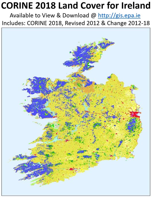
Congrats to the Stuart, Jesko and the other organisers yesterday from Teagasc - beginning with the announcement that Team Teagasc won the Farming by Satellite competition hosted by ESA during the week, followed by a great keynote by Dr. Daniel McInerney from Coillte on Open Source processing methods for forestry, and then a full day of great sessions - it was a really useful day of talks. We presented on our work with OSi on the Change Detection project, and OSi and EPA followed with a joint presentation on their work on Land Cover/Habitat Mapping. Kevin Lydon from EPA also announced the release of the new Corine 2018 dataset.


There was a great turn-out from the Maynooth MSc GIS/RS students - which I hope they really found useful. The difference in seeing people who work on a single theme every day (like marine, or Ag) present their problems and solutions really helps to show how important some of the things i keep banging on about are - like automation, data fusion, data calibration, accuracy assessments. It was lucky that it was so close to Maynooth this year - if had been hosted in UCC or NUIG for example they wouldn't have had that chance to just hop on the train.

My surname ended up as Calahane on the name badge, as usual.

Today is Day 2 - with the python coding workshop.

About Me

My photo
My name is Conor. I am a Lecturer at the Department of Geography at Maynooth University. These few lines will (hopefully) chart my progress through academia and the world of research.