A innovation I have come across a number of times recently in wind energy is the use of light weight kites or similar to generational rotational energy. These are alot cheaper than the traditional turbines and easier and quicker to deploy. Looking through the Irish Times recently I came across an article about a plan to use drones in a kite surfing fashion to generate energy and a test site had already been identified off the coast of Mayo. Ireland 'has the best wind' apparently - just the best. It is interesting to see drones possibly providing energy as usually they just use it up!
Thursday, 27 April 2017
Monday, 24 April 2017
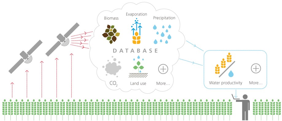
WaPOR
A UN project using satellite data for monitoring and improving water use and management in Africa and the Middle East has gone beta this week. They use real time satellite data (although quote 1 to 10 days as the time delay - so it is more near real time) and Google Earth Engine to do the processing. One to watch and must forward it to a Californian friend of mine who is dipping his toes into Precision Ag. Spatial resolutions of 30m to 250m, so I'm guessing Landsat is the smallest they use?
Thursday, 13 April 2017
Potree - Denmark
This is extremely impressive. An RGB point cloud in a web viewer for the whole of Denmark - runs quite smoothly too but keep the fire extinguisher near the PC when you start panning to view multiple areas...

Subscribe to:
Posts (Atom)
About Me

- Conor
- My name is Conor. I am a Lecturer at the Department of Geography at Maynooth University. These few lines will (hopefully) chart my progress through academia and the world of research.