A innovation I have come across a number of times recently in wind energy is the use of light weight kites or similar to generational rotational energy. These are alot cheaper than the traditional turbines and easier and quicker to deploy. Looking through the Irish Times recently I came across an article about a plan to use drones in a kite surfing fashion to generate energy and a test site had already been identified off the coast of Mayo. Ireland 'has the best wind' apparently - just the best. It is interesting to see drones possibly providing energy as usually they just use it up!
Thursday, 27 April 2017

Monday, 24 April 2017
WaPOR
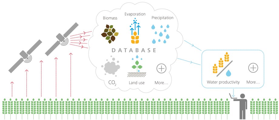
A UN project using satellite data for monitoring and improving water use and management in Africa and the Middle East has gone beta this week. They use real time satellite data (although quote 1 to 10 days as the time delay - so it is more near real time) and Google Earth Engine to do the processing. One to watch and must forward it to a Californian friend of mine who is dipping his toes into Precision Ag. Spatial resolutions of 30m to 250m, so I'm guessing Landsat is the smallest they use?
Thursday, 13 April 2017
Potree - Denmark
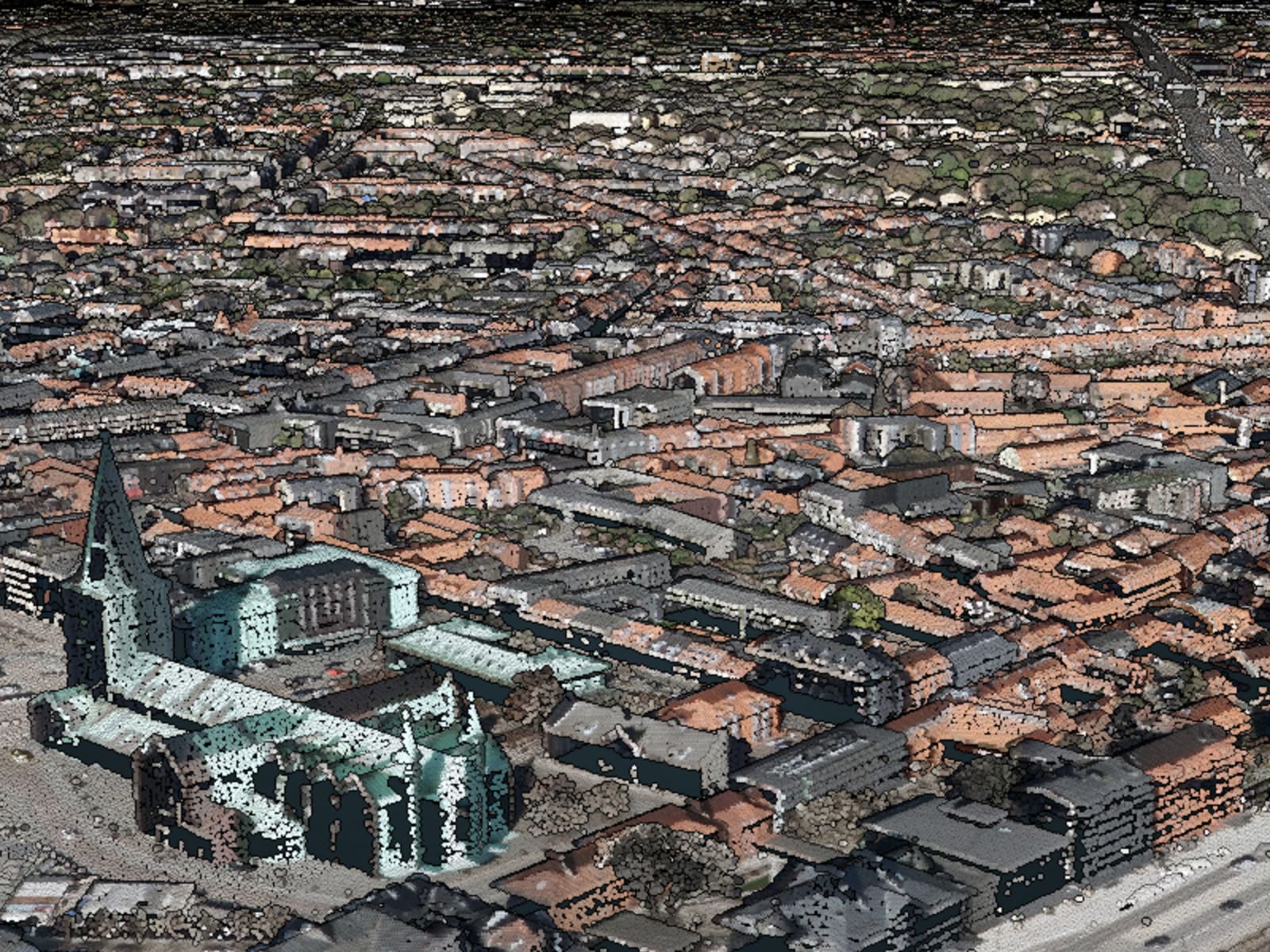
This is extremely impressive. An RGB point cloud in a web viewer for the whole of Denmark - runs quite smoothly too but keep the fire extinguisher near the PC when you start panning to view multiple areas...
Thursday, 30 March 2017
Launch of MUSSI
The Maynooth University Social Sciences Institute (of which NCG and NIRSA are part) is being launched today by Minister Richard Bruton. The place looks well!
Wednesday, 22 March 2017
CIG 2017
I notice abstract deadline for the CIG is rapidly approaching - must get my skates on and see if we can present some of the iCRAG MAROBS platform highlighting our work in the coastal zone.
Tuesday, 21 March 2017
Two new projects
A short update after a busy few weeks.
1) The 2 year change detection / change classification project has started and I hope to have some concrete information to post on that soon.
2) ESA has awarded the SCSI RS & EO Working Group a very generous allowance of Pleiades tri-stereo optical and TerraSAR X 'Staring Spotlight' imagery - we'll be starting a project looking at assessing the suitability of Satellites for BIM (i.e. the entire building lifecycle) in the coming months and will also hopefully have updates from that.
Wednesday, 1 March 2017
Four Million Solar Panels
An interesting example of changes in the landscape detected by satellites in space, here we have FOUR MILLION solar panels installed in the Longyangxia Dam Solar Park in China. I have a feeling that China will go from being the bad boy of the emissions world to its shining light in the very near future, especially as the USA will take its foot off the gas (not literally - they will keep their foot on the gas just as much as before and their cars are MASSIVE) over the next four to eight years. I did a quick search and the solar panels begin to appear in Landsat 5 imagery in late 2012.

Subscribe to:
Posts (Atom)
About Me

- Conor
- My name is Conor. I am a Lecturer at the Department of Geography at Maynooth University. These few lines will (hopefully) chart my progress through academia and the world of research.