Tuesday, 16 October 2018

National Space Strategy

Summer is never a good time to elicit responses for an important consultation but nevertheless there was a call for comments on the Space Strategy for Ireland in July/August. As part of the SCSI Working Group in Earth Observation and Remote Sensing, I worked with a few other members to highlight some of the concerns we had in relation to spatial data, applications, industry potential, outreach and skills gaps. I was not surprised to see that at the follow up meet most, if not all companies had the same concerns. The downstream sector was definitely in the majority - but I got the impression that the concerns of the upstream got the better airing as the morning wore on. One thing that surprised me - I had always heard anecdotally that the upstream was doing better than down, but this seems not to be the case. 

DBEI organised and was hosted by DFF&T at the beautiful Iveagh House. Like the Korec seminars in Carton House - you spend more time gazing at the ceiling than the speaker.


Some general observations, although I'm sure this will be formally published in the near future. 
  • Siloed interests abound - many people unaware of what supports and who is out there for potential collaboration.
  • Lack of coordination at national level - talk of a 'space coordinating centre' was judged overkill but a single space officer to combine ESA, Copernicus and other EU info was universally agreed as important. There was an extra €500k in the budget alotted for ESA work this year, it may feed into it?
  • Skills shortage - particularly at undergrad level - on both EO side and also at the engineering side on materials - i.e. space tech manufacture or RS are only single modules, rather than a full programme. Seems to be demand in the industry for those graduates - SAR skillset an EU wide shortage.
  • Currently there is an overdependance on ESA for contracts - NASA, UN, H2020 other world orgs should be considered.
  • Lack of a big space industry in Ireland is hampering growth - some discussion on trying to coax a large space player to Ireland, but would have to avoid hampering native industry who are currently growing.

Hopefully will lead somewhere.


Thursday, 27 September 2018

MSc in GIS and RS - SCSI Accreditation Event

It is great to be able to announce that the Maynooth University Department of Geography MSc in GIS and Remote Sensing is now formally accredited by the Society of Chartered Surveyors Ireland (SCSI) and the Royal Institution of Chartered Surveyors (RICS). We had the event yesterday in Rocque lab and even the beautiful old maps by the entrance got an airing. That pic is taken beside the Manor of Maynooth survey by John Rocque in 1750 approx.


Accreditation opens alot of doors to students who go on to pursue it upon graduation and it have even backdated eligibility for the last three years of the MSc graduates so hopefully they will start down that route too. As for me my original motive was to get more juicy brains for the RS and EO working group but now I am back here teaching that changes my outlook somewhat!

Thanks to Colin Bray (CEO OSi and immediate past president of the SCSI) and Prof Maria Pramaggiore (Dean Graduate Studies) for coming along to speak at the event. A special thanks to James Lonergan from the SCSI for all his help in getting this over the line - his input really made a difference and delighted that he is in SCSI HQ helping us with going forward.

Out-suited again, I never seem to get that one right.

Sunday, 23 September 2018

AR Sandbox

My dream of getting my hands on an AR sandbox become a bit less fantastic this week. I had decided by hook or by crook that I would get the hardware and start making one - some great online guides, even AutoDESK have one up there - but I was alerted via twitter of one that was already in Maynooth! The CS department 'Makers Club' had built one with some French interns a few years back. I will get my begging bowl out and see if they might let us borrow it for Geography Week which is coming up soon. If it is a hit we might look at making our own, we have most of the hardware except the Kinect sensor.


Sunday, 16 September 2018

Drones and Motorway Mapping

I see Korec have won a contract with Transport Infrastructure Ireland to provide 2 drones and also map the motorways. The statistic that one drone can cover as much ground in an hour flight as a survey team does in 14 days is very impressive, although I wonder is that an area based measurement - whereas a road is a route corridor? Drones are limited by LOS still, and basic restrictions are 300m. Unless the operator will drive along underneath? Interesting all the same. Having worked on QBN surveys back in the boom I think the most survey points I captured in one day was around 2200 - and that was a busy busy day, so not hard to see how drones will speed things up, if not get the same level of accuracy. 

Poor Mobile Mapping Systems - they were just too expensive to catch on over here, drones are a fraction of the cost. I know Korec haver access to one of the Trimble ones - they brought it in for the IEOS in 2014.


Friday, 14 September 2018

Aerial surveys, drought and archaeology

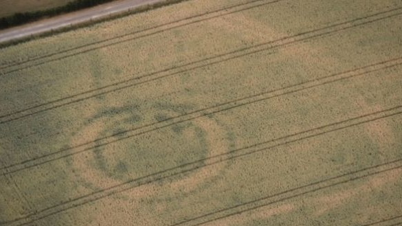
The extremely dry conditions over the past 4 months really has resulted in perfect conditions for archaeologists to spot new sites of interest, usually via airplane, drone or even satellite. From drones spotting new info at newgrange, to abandoned farmsteads at the bottom of reservoirs appearing for the first time in generations spotted by aerial survey teams, to satellite finding new sites in the UK, there really is great potential for a change detection study using some HR imagery around the countries that had the worst of the drought. I wonder what Copernicus might pick up? 


Friday, 31 August 2018

An chéad staisúin eile...atá.... Maigh Nuaid....arís!

Followers of this blog might remember this post from early 2018, I had taken up a new position in DIT after almost 10 years at the NCG. Well after a hectic but enjoyable year I interviewed for a RS Lecturer role in the Dept Geography back in Maynooth. I'm very glad to say I got that post - great department, good research support structure, closer to home - too many benefits -  and am starting there next week. Today is my last day in DIT, so I am finishing grading repeats, backing up data and basically getting ready. My colleagues here in DIT were a great bunch, very welcoming and I will be sorry to leave them - but I know from experience (not just in The Roost) that the staff at Dept of Geography are a great bunch too so looking forward to starting there.

Now lets see if I can get a paper cracked out in the 2 or 3 weeks before classes start back - I have material for two ready to go.

Goodbye for now DIT and congrats on the TUI award.


Sunday, 5 August 2018

Parallax and Mapping the Stars - ESA Gaia Satellite

ESA have released a beautiful video here showing how parallax (the apparent change in position of an object when viewed from two different locations - varies by range) can be used to measure the locations/distances/orbital paths of different stars and galaxies (not sure how far they go out in this video). The parallax has been greatly exaggerated for display purposes (100000 x times!) and the motion has been sped up one trillion times for the video but well worth a look for anyone working in RS or photogrammetry.

About Me

My photo
My name is Conor. I am a Lecturer at the Department of Geography at Maynooth University. These few lines will (hopefully) chart my progress through academia and the world of research.