Tuesday, 21 July 2015

POLWET

Just back from 2 weeks in Poland at SWAMP:  the 6th EUFAR-OPTIMISE Training Course for spectroscopy in wetlands using aerial, satellite and UAV imagery. OPTIMISE, you might remember is the EU COST Action that I am a part of so this was particularly relevant to me. Here is an orthomosaic of the test-site with some of our sample locations.


I applied for a place on the course and was awarded full funding for the two weeks. From what I hear only 25% of the applicants received places so I was lucky to get one. You might think there would be alot of down-time in a course that long but it was almost non-stop from 9am till 11pm at night, particularly towards the end getting the results finalised.

Lots of great hardware/data collected on the survey -

- At least 4 UAVs, some were  really heavy-lifter VTOLs (no fixed wings, they were deemed not steady enough for spectral measurements - quite a few of the things I learned challenged our assumptions and have made me think about the path we are moving down). The Falcon was the man-of-the-match in many cases due the the gimble and its ability to calculate BRDF for the hemisphere above and around a point without obscuring any illumination.

- Two large aerial platforms - a Dornier carrying the 'APEX' sensor and a second aircraft with 'HYPLANT'.

APEX

HYPLANT

- More field units than you could sneeze at. Here is a nice photo I took of us using an Ocean Optics HR4000 and the Falcon operating in the background.


- A flux tower for eddy-covariance measurements.

- They had even tasked a Sentinel 2a overpass and there is talk of using our field and aerial measurements for calibration.

Lots of hard work but also lots of very interesting people. Some great BBQs, bonfires and beer for less than 1 euro.

I need a holiday!


Tuesday, 30 June 2015

Whales!

I think satellite remote sensing is about as close to seeing whales as I am ever going to get. Another weekend spent waiting for news from the boat captain in Baltimore, West Cork. Cancelled at the last minute due to bad weather. That is the 4th or 5th time it has fallen through I think? I wouldn't mind but today is supposed to be the start of a heat wave!

I'm not giving up though - October is supposed to be the best time of year for whale watching in SW Ireland and I will be back then.

Tuesday, 23 June 2015

Sentinel 2a in orbit

About a year and a half ago I stayed up to watch the launch of Sentinel 1a and make sure it made it safely into orbit (not as if I could influence that much). I have just received an email from GIM International informing that Sentinel 2a has stolen a march on me as I thought the launch was not until tomorrow.


So while I was up watching the first episode of the new series of 'True Detective', Sentinel 2a was entering sun-synchronous orbit without my help. Unlike Sentinel 1a, Sentinel 2a is an optical multispectral satellite and will be very useful in the coming years with a MS resolution comparable with SPOT 4 and 5 (10metres).  Up until now the highest spatial resolution, free MS imagery that you could get without applying for it was the 30m bands on the Landsat series.

Watch this space.

Monday, 22 June 2015

Meeting the Challenge of Climate Justice

Mary Robinson just finished her keynote speech at #climatejustice2015. This is the conference I posted the video for a few weeks back.


Pros
Very good speaker and a great sense of humour.


Cons
Very good speaker = minimal elbow room.

Friday, 12 June 2015

Scale

Someone directed me to a great quote during the week on the subject of scale...

................................

"That's another thing we've learned from your Nation," said Mein Herr, "map-making. But we've carried it much further than you. What do you consider the largest map that would be really useful?"

"About six inches to the mile."

""Only six inches!"exclaimed Mein Herr. "We very soon got to six yards to the mile. Then we tried a hundred yards to the mile. And then came the grandest idea of all! We actually made a map of the country, on the scale of a mile to the mile!"

"Have you used it much?" I enquired.

"It has never been spread out, yet," said Mein Herr: "the farmers objected: they said it would cover the whole country, and shut out the sunlight! So we now use the country itself, as its own map, and I assure you it does nearly as well"

from Lewis Carroll - The Complete Illustrated Works.

Wednesday, 10 June 2015

Scientists can have hobbies too

I posted a while back about completing the release candidate on a software package to send to our distributor. Well the final version was released yesterday and it is getting some great feedback already. As the lead on the QA team I am just happy that it didn't crash everyones PCs.

Don't tell any of my geomatics friends that I am a closet historian...

Tuesday, 2 June 2015

Discovery Programme

I am a big fan of the Discovery Programme. They are always one of the highlights of any remote sensing conference with such beautiful, high quality models. I use their images in my LiDAR lectures and show the students the free to access, online, great collection of 3D models for most of the heritage sites around the country.

Here is a great shot of their DĂșn Aonghusa model. You can also look at RGB point clouds and pan and zoom as you like.


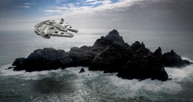
So I was very glad to see the formal launch of their project getting a mention in thejournal.ie a few weeks back. The DP also have some full scans of Skellig Michael, I wonder did they use them for the new Star Wars movie? I know they were filming there.


About Me

My photo
My name is Conor. I am a Lecturer at the Department of Geography at Maynooth University. These few lines will (hopefully) chart my progress through academia and the world of research.