Wednesday, 11 June 2014

VRS link to UAS

One of the reasons I got involved in the COST action was that they were going to look at ways of improving UAS navigation accuracy during the mission, not just using ground control and post processing once you were back in the office. I had met MaVinci UAS vendors at Survey Ireland this year who were selling a Sirius Pro


which had a base station link and could negate the need for ground control, but I wasn't sure was this just providing high accuracy Geotags that would then be used in post-processing the data. Either way it was impressive....

Today - SenseFly (the guys who almost started the survey UAS craze with the Swinglet) launched the latest version of the eBee, the eBee RTK


Which not only has a base station link, but also works by VRS. VRS is something most surveyors will be familiar with, it is a mobile phone/internet, 'virtual reference station' that provides the GNSS receiver with real time corrections from the local active station network. In Ireland that's operated by OSi, although a number of vendors have created their own to ensure they could have them where they wanted them and to avoid problems if OSi took the off-line for any reason. Added to that - they very clearly state that real time corrections are being transmitted to the UAV mission planning software and the flight plan is being updated constantly. This is particularly important for UASs operating the push broom type of spectrometer, where post processing or image matching is not an easy option.

Tuesday, 10 June 2014

SFI Industry Fellowships

We were informed of our awards back in October 2013, but the official announcement was only made yesterday.


I was one of the lucky ones called for the SFI photoshoot with the minister and was up early getting suited and booted when I got a congratulatory text informing me that my surname had been mangled on Newstalk (no surprise there).

The projects are listed around 9:40 here Newstalk Podcast

I got a mention (probably because I was also going to be at the photoshoot), as did Tim McCarthy and TreeMetrics.

The project also got a mention hereherehere and here.

So we went in for the photoshoot and the full press release was released yesterday PM here.


Wednesday, 28 May 2014

ESPON Conference and NUIM publication scheme

Three posts in three days!  It has been a busy week, lots of news.

I'm off next week to Greece for the ESPON conference on 'Blue Growth' and 'Urban Poverty'

Linky

The conference is in Napflio, and it looks like a beautiful spot.


Having said that, the flights are usually delayed going out and we have a bus transfer at the airport we need to make. Added to that, Napflio is 180km from Athens airport so if we don;t make the bus we have some exploring to do...

I also got word this morning that my application to the NUIM publication fund was (partially) successful. I applied for publishing costs for two papers - one I mentioned in the previous post. The second hasn't been accepted yet, so they declined to cover that. Still - €1,475 covers the first paper nicely, and maybe I can get the costs for second covered elsewhere.

Everyone loves free stuff!


Tuesday, 27 May 2014

Journal Paper

Ok, I know I posted yesterday but this is too big a milestone  not to have a quick update.

After a big delay trying to commercialise my research, and even bigger delay due to some slightly dubious dealings with another journal, I had my first paper accepted.

Calculation of Target-Specific Point Distribution for 2D Mobile Laser Scanners


Linky

After discussing the situation with the Professor at the NCG, he very kindly gave me permission to go for an open-access journal, Sensors, as rest of the available options were linked to said dubious journal. Open access journals bypass the traditional publication model by charging readers/libraries for subscriptions and move the cost to the author. I won't say I am overjoyed at having to pay for my first journal paper, or at not having a hard copy (when you picture your first journal paper during work on your thesis - it's a not a pdf), but I am delighted to have gotten it into such a high impact factor journal. It's higher than most of the more common subscription based RS journals, and I use their papers regularly. I have another one ready to go to Sensors's sister journal, Remote Sensing.

May there be many more.

Monday, 26 May 2014

It will be alright on the night

Except it wasn't....

Bad weather and UAVs are not a great combination - and although the Falcon performed very well on other occasions (like the Portrane beach survey or Operation Cathach in the Shannon estuary) , the wind was too much for her on this project. Plus with an RTE camera crew filming the whole affair, it wasn't great timing...oh well, you can't plan everything...

The background
Last year we were on an RTE show called 'Science Squad' demonstrating the use of UAVs for agricultural surveys. (Not us in the image - but Stuart from Teagasc who did the satellite part of the show). The video is down now off RTE player for some reason....


After that, NCG were contacted by another RTE presenter and asked to help them with two new shows - one for forestry, and the other for monitoring coastal erosion - both with John Creedon. So after a few months we were headed down to Limerick and Dingle for two days of filming.

Forestry
The first site was a privately own forest near Abbeyfeale in Limerick. We used the UAV to identify areas of damage quickly and easily, and provided a significant saving in time when compared to manual investigations of sites. The wind was high, but the Falcon was up to the task (and up a tree for a short period).

Coastal erosion
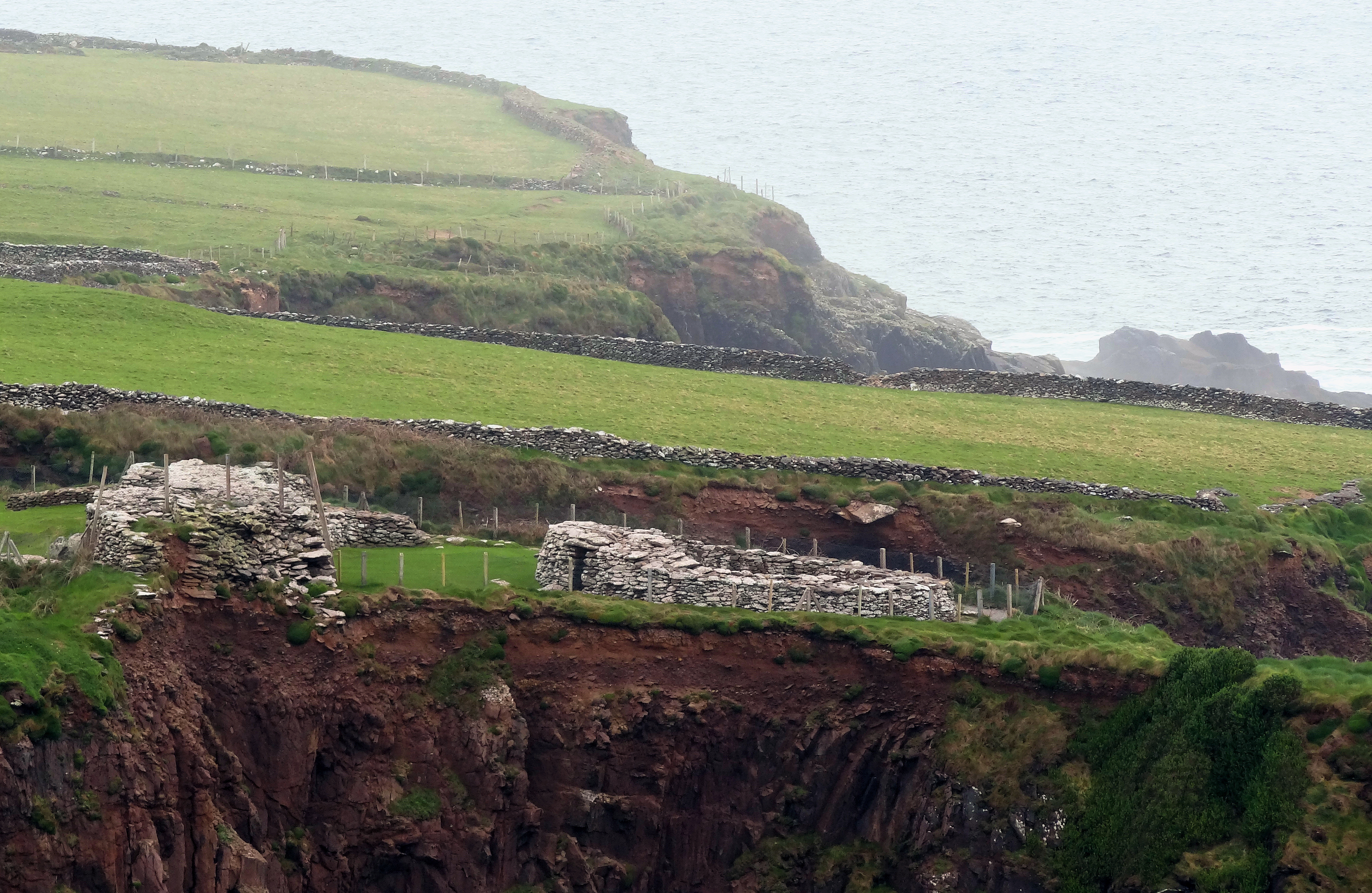
Next stop was Dingle - and more specifically Dunbeg Fort, an old coastal fort that is about to drop into the sea.


The wind was too high at this site, and having heard horror stories from other UAV operators about Drones heading out to sea and being too under-powered to make their way back in land against strong headwinds, we had to admit defeat. We returned early the following morning to try and catch a lull in the weather but no luck. We spent the rest of the morning capturing spatial video on UbiPix and tried again in the afternoon, but the wind was too strong.

http://app.ubipix.com/playvideo.php?id=tAw8xA6Lhab

Two sites, one survey.

NCG 1 - Wind 1


Thursday, 17 April 2014

COST Actions

It's been a busy few weeks but a good few weeks. After some great advice from a colleague,


I decided to have a look at EU COST Actions. COST Actions are part of a European framework supporting cooperation among scientists and researchers across Europe. I found a COST Action in a very relevant area - EO and UAV applications for agriculture. It even crosses into UAV accuracy assessment - something that I presented a paper on at the RSPSoc conference in Glasgow last September.


I got talking to someone from Edinburgh university afterwards about the same thing and it turned out that months later when I started looking into COST Actions, he is the one chairing it. So after a quick email to make sure the goals of the study corresponded with ours, I started to put together an application for the Enterprise Ireland reviewer, as they decide who to nominate as the Irish representative for the management committee. She agreed to nominate me, and the rest is history. I'm off to Brussels in the next few weeks for the kick-off meeting. Lots of excellent opportunities for networking and a chance to find out how people are getting on with their own multispectral or hyperspectral cameras - something I mentioned a few posts back.


Added to that, I got some good reviews of a journal paper and found €200 in an envelope in the attic when throwing out old files! Which will come in handy - as this comic from The Upturned Microscope should explain nicely.


Friday, 4 April 2014

Sentinel 1a Launch

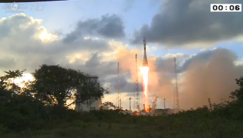
Great to see it go - it's the first satellite that I have followed the progress, watched the launch and also actually really cared about it not crashing.


I was following the countdown during the day and 'stayed up' (launch was around 21:30GMT) for the whole thing. It wasn't too far behind the scheduled time either, I think only delayed by about 5 mins compared to the countdown timer. It must be a really impressive sight to see a rocket launch and I've just added it to my 'bucket list'. Maybe I can get a job as a book loader with Amazon?

Books in space

Of course even though launch went well doesn't mean it was out of the woods. Landsat 6 didn't make orbit, so I watched Sentinel 1b past the first three stages and the mission control team seemed happy so I left it at that (plus I was now just watching a computer simulation because no camera were on it). And although Landsat 7 did make it, the problems don't stop there. Sensors can develop problems (Landsat7 is optical - Sentinel 1a is RADAR) so lets hope it is all working fine in a few months time when calibration is complete.


So now the next big event is Sentinel 2a in 2015? Sentinel 1b won't be lauched until 2016. Considering how many funding applications and projects around the EU probably depend on the safe launch of these satellites we should probably have had a party afterwards! Shame the guys in the ISS couldn't see it - how cool would it have been if we could have followed it post launch on this!

ISS Cam

About Me

My photo
My name is Conor. I am a Lecturer at the Department of Geography at Maynooth University. These few lines will (hopefully) chart my progress through academia and the world of research.