Monday, 19 June 2017

Clouds and Contrails

One of the projects we are working on is the SCSI/ESA funded "Satellites for BIM" assessing the suitability of satellites as a tool for planning and monitoring construction projects in coastal regions and ensuring environmental compliance throughout the project and afterwards when the site is operational. We have been awarded some TerraSARX Staring Spotlight imagery and some Pleiades Tri-Stereo Optical. The TSX data was very easy to order, due to the cloud penetrating capabilities, it was done in 2 emails. The optical on the other hand must wait for a cloud free opportunity to coincide with the satellite overpass - and we have had to cancel the last three acquisitions due to this. The weather over this weekend was great, really as good as Ireland gets in the summer but unfortunately the next overpass was not due until today. Looking at the HighRes visible image over the country there is a bank of cloud further north but Dublin bay (our target site) is relatively free from cloud cover, which is very promising. However, you do notice a network of intersecting lines of clouds that look to me from the pattern to mimic air traffic passing over Ireland to the UK and the rest of Europe and are therefore almost certain to be contrails left by airliner traffic overhead - and these are sitting over the bay.... I have listened to Gillian Whelan in UCC present a number of times on these - contrails can form a foundation for other clouds to form on, so they get bigger with time rather than smaller and they can spread over a significant distance. They also contribute to global warming as they reflect some of the suns energy back down to the earths surface.


Hopefully they wont interfere with the satellite tasking, it should be due in the next hour. Bad weather is due back again on Wednesday.


Update - Rejected!


Update 2 - What a difference a few days made. This was the S2a overpass on the 17th, hardly a cloud to be seen from Waterford to Armagh.


Update 3 - Success. We got lucky on the Tuesday. Tri-stereo Pleiades imagery captured - looking forward to seeing what we can make with it.


Tuesday, 6 June 2017

USGS Updated Spectral Library

The USGS have released an update spectral ibrary - it even seems to contain the beginnings of an oil library. A lack of a suitable library (and cloud free dates to get images of slicks!) was one of the main problems I encountered in the iCRAG project so this is a very welcome update.

"Spectra of oil emulsions, residues and oil-contaminated marsh plants from the BP and Deepwater Horizon oil spills are included"

Primarily spill related but still better than nothing. I'm sure we have Mark Wahlberg to thank for it....

Saturday, 3 June 2017

OPTIMISE BUS

OPTIMISE, an EU COST Action looking at spectral measurements from UAV are looking for respondents for a survey into people's uses of UAV for spectral measurement campaigns.

Fill it out if you have 5 mins free


No matter how many times i read that logo, i cant help but read it as OPTIMnISE.


Thursday, 1 June 2017

Survey Ireland 2017

A very interesting line up at yesterday's Survey Ireland. 

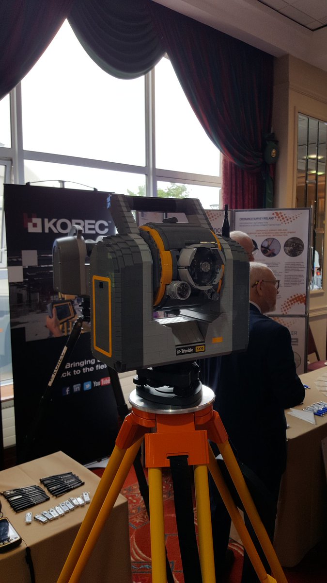
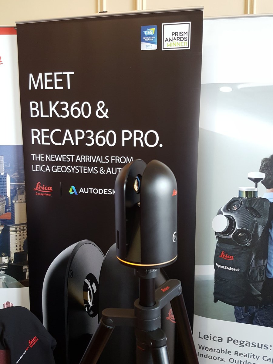
Back in Malahide for the first time since 2008/9, a favourite venue over the years, the event was very well attended with topics including GSI mapping, BIM, drones, laser scanning, luas works, smart cities, satellite mapping and the Malahide viaduct collapse in 2009. I got to use some very interesting VR headwear (interestingly the 'exit' menu was accessed by looking in to a toilet bowl in the VR scene) and I saw two very interesting developments -the first was a total station/laser scanner combo made entirely of Lego and the second was a new lightweight measurement device from Leica capable of capturing spherical imagery, laser scan data and thermal imagery simultaneously.

I'll let the reader decide which is which - because I almost did not notice that one of them was made of Lego and was moving in with questions......


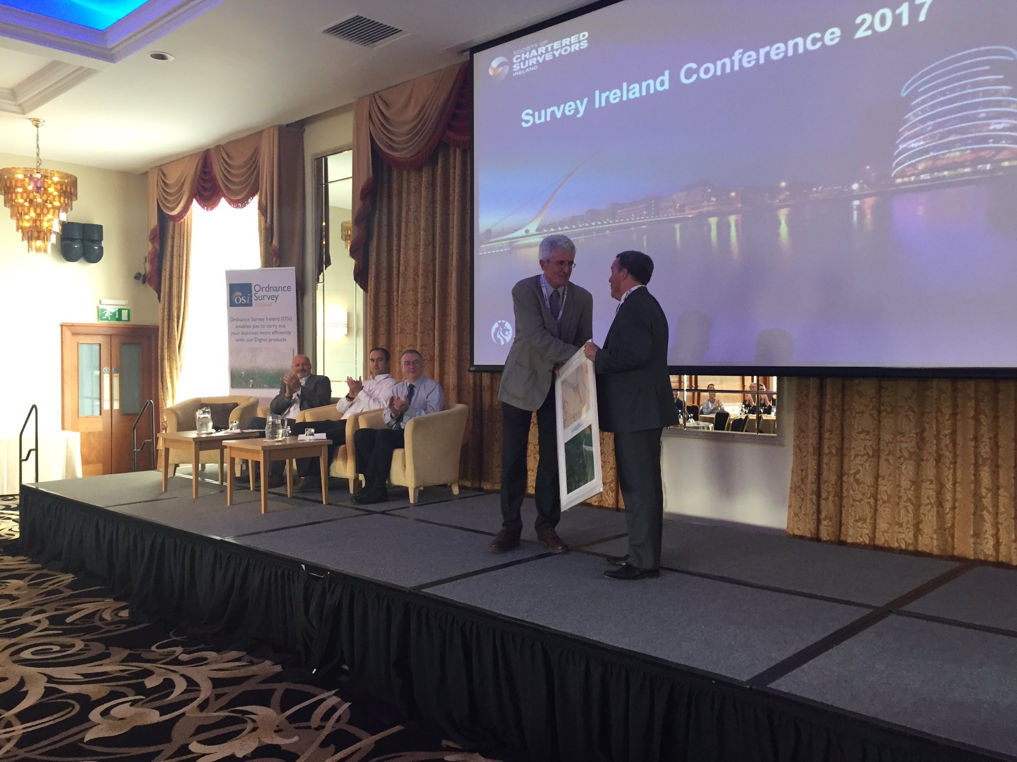
DIT veteran Kevin Mooney was also presented with an award at the event for his long service to Geomatics in both Ireland and abroad and took the opportunity to get a few well aimed digs in at the mucky boots in the audience - well done Kevin, for the digs and all the hard work.


I was peddling my usual wares on the 'applications of satellite imagery' and got quite a number of questions afterwards on where to get the software and data - hopefully some of the opportunities are becoming evident. I also got a nice bottle of wine for chairing the afternoon session - thanks for that SCSI.

About Me

My photo
My name is Conor. I am a Lecturer at the Department of Geography at Maynooth University. These few lines will (hopefully) chart my progress through academia and the world of research.