Except it wasn't....
Bad weather and UAVs are not a great combination - and although the Falcon performed very well on other occasions (like the Portrane beach survey or Operation Cathach in the Shannon estuary) , the wind was too much for her on this project. Plus with an RTE camera crew filming the whole affair, it wasn't great timing...oh well, you can't plan everything...
The background
Last year we were on an RTE show called 'Science Squad' demonstrating the use of UAVs for agricultural surveys. (Not us in the image - but Stuart from Teagasc who did the satellite part of the show). The video is down now off RTE player for some reason....
After that, NCG were contacted by another RTE presenter and asked to help them with two new shows - one for forestry, and the other for monitoring coastal erosion - both with John Creedon. So after a few months we were headed down to Limerick and Dingle for two days of filming.
Forestry
The first site was a privately own forest near Abbeyfeale in Limerick. We used the UAV to identify areas of damage quickly and easily, and provided a significant saving in time when compared to manual investigations of sites. The wind was high, but the Falcon was up to the task (and up a tree for a short period).
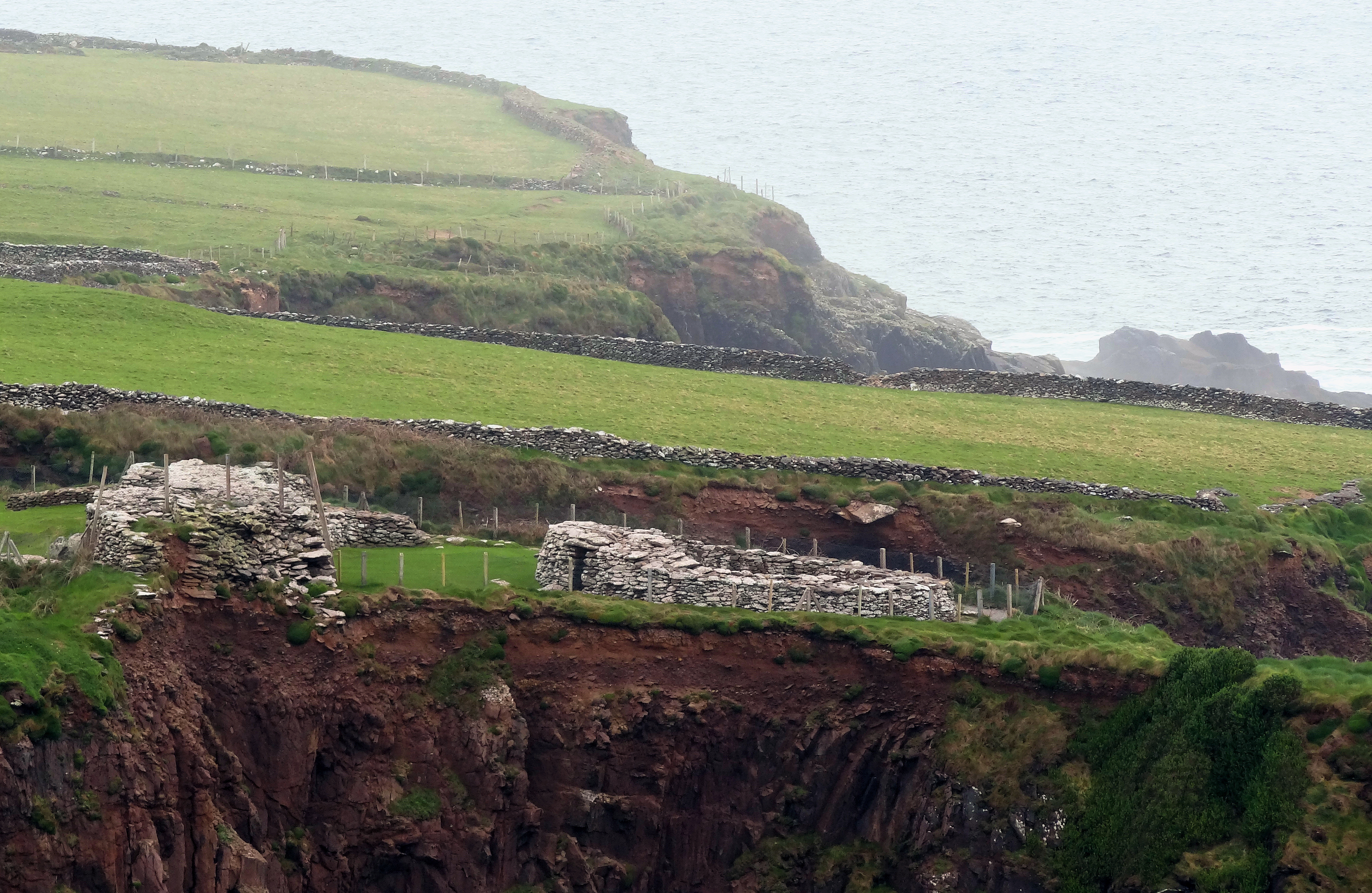
Coastal erosion
Next stop was Dingle - and more specifically Dunbeg Fort, an old coastal fort that is about to drop into the sea.
The wind was too high at this site, and having heard horror stories from other UAV operators about Drones heading out to sea and being too under-powered to make their way back in land against strong headwinds, we had to admit defeat. We returned early the following morning to try and catch a lull in the weather but no luck. We spent the rest of the morning capturing spatial video on UbiPix and tried again in the afternoon, but the wind was too strong.
http://app.ubipix.com/playvideo.php?id=tAw8xA6Lhab
Two sites, one survey.
NCG 1 - Wind 1