Tuesday, 10 April 2018

Dun Laoghaire Pier - Network Surveys

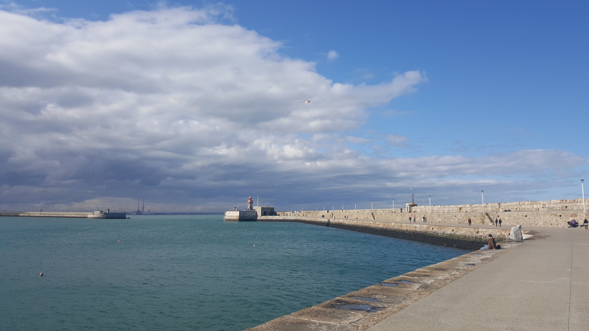
Monday was a beautiful day out in Dun Laoghaire for the start of the network survey with the 2nd year Geos. Windy but sunny - the clouds started to roll in around 3pm, reminded me of my lunchtime walks when I was working with TWM before the office moved. Had a quick look around the library too - impressive.


Stage one as always is the recce - but when the students returned it turned out that large portions of the upper east pier was closed off due to storm damage either from Ophelia or Emma. I don't know if these slabs had been moved by waves crashing in and up from under the pier or they are the replacements (they don't look damaged) or else they had to remove them to access other damage but still these are big pieces of rock...


This meant all of those stations had to be repositioned for the network measurements and the rest of the day was spent doing that, only allowing a short amount of time in the PM for measurements from stations at the ends of either pier. This also meant reduced visibility as the students were now trying to see across the harbour from lower down. Lots of radio contact required to ensure inter-visibility,


Level survey and topo to follow later in the week but I am off to Grangegorman to help with the first year field trip there, looking forward to seeing it.

Saturday, 24 March 2018

EO and Ocean Plastic

My new years resolution is to use less plastic - thanks Blue Planet II - one of the big problems it has highlighted is large patches of ocean plastic, some of them as big as a large country. With projections estimating that there will be more plastic in the oceans than fish by 2050 it is important to start finding the problem areas so solutions can be developed and targeted. That is where I am not surprised to see EO playing a role. Looking for the spectral signatures for plastics, imagery from satellites such as Sentinel 3 is playing a role between ESA and industry partners in helping to do just this and creating maps measuring density of plastics in ocean regions.


Saturday, 17 March 2018

GDPR and Drone Operations

I attended a very interesting CPD event at SCSI HQ earlier in the week - it covered upcoming changes to regulations for drone operations and also privacy issues. Privacy for drone surveys had always been a bit of a grey area, the IAA weren't regulating it, the GardaĆ­ weren't - etc. The big change coming down the line will be the EU's General Data Protection Regulations (coming into effect on 28th May) and privacy will be a major consideration then with massive penalties for non-compliance (up to 10% of a companies annual turnover!). Terms such as a data processing impact assessment should put shivers down the spines of anyone considering flying in the coming months until it is clearer what effect it will have on surveyors and also the best way to plan for it.


As the Christine Woods from Matheson explained - "act now as preparation is necessary to achieve compliance".


Wednesday, 14 March 2018

Clouds in Google Earth

I just looked at the new Google Earth in my browser - I don't have the desktop version installed ion the DIT PC yet. Your first view is a beautiful 'blue marble' / globe that reminds me of the old Civilisation games.

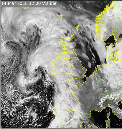
As I zoomed back out hoping to enjoy the view of the whole hemisphere with Ireland at the centre point, a pile of cloud appeared over the country and most of Western Europe. "What a pain", I thought but also admitted it was quite realistic as it is lashing down outside (the second years spent the day down the minesin Tara, a perfect day for it - warm and dry) and it occurred to me that it just might be a real time feed? So I checked it against the Met Eireann full-disk satellite feed and lo and behold it matched that shape exactly. So real time cloud maps are available by default in Google Earth - impressive.


Google Earth
Met Eireann
Note the matching fishhook shape over Ireland and the arc further to the north. 
 

Wednesday, 28 February 2018

Survey Ireland 2018

Survey Ireland 2018 is scheduled for the 30th May in Dunboyne Castle - the first time at this venue I think. The schedule is not finalised yet but will cross over with 'smart cities' and the enabling survey tech. I hope to present some of our work on satellite mapping of construction in Dublin port at it.

Details here


Sunday, 25 February 2018

Conference of Irish Geographers 2018 - Earth Observation Session

The call for abstracts for the EO session at CIG2018 has gone out - details here. Should be an excellent session and I'm looking forward to seeing friends from Maynooth again. This is the 50th event in the series and will run from Thursday 10th of May to Saturday 12th of May 2018.


Friday, 23 February 2018

Potree Dublin

I refuse to let February go by without posting on the blog but I have never been this busy in all my life. Added to that I have a new gmail log-on for DIT so I can't edit the blog from that! Plus I have to admit that twitter is getting more of my attention these days as you can see from the side panel - its an easy way to pass a train journey and sharing content is much easier than here.

Thanks to Daire letting me know this is working - I tried to show the students a few weeks back but it was down. Potree back in my feed again . You might remember some of my previous posts on this online point cloud viewer - they had a complete RGB pointcloud of Denmark, plus forestry walk thourhgs. Well now they have updated it to include a LiDAR model of Dublin (looks like the UCD one).

Really impressive - no RGB data that I can see but you can colour by intensity, elevation - take measurements.


About Me

My photo
My name is Conor. I am a Lecturer at the Department of Geography at Maynooth University. These few lines will (hopefully) chart my progress through academia and the world of research.