I came across a great video demonstrating what appears to be the fusion of aerial and terrestrial point clouds. This combination really is impressive and demonstrates potential for LiDAR and photogrammetry for archaeology.
link here
Tuesday 21 February 2017
Saturday 11 February 2017
Drones and natural selection
I came across this post looking at a new microdrone capable of collecting pollen. This is proposed as a possible solution to the problems arising from the collapse of so many bee colonies. Colony Collapse Disorder has the potential to wipe out agriculture worldwide when we have nothing to pollenate crops.
It is an interesting solution from the technical side, but one that got me thinking on natural selection. Examples of plants that had developed particlar shapes or colours over millions of years so that specialist animals or insects were the only ones to unlock the pollen or nectar. In a horrible future where we had no bees and 'busy as a drone bee' was a common phrase, I could not think of any reason why natural selection might not also adapt plants to drones. Those that drones can pollenate easily are the first to thrive and those characteristics improve with each generation. Special petal arrangements to avoid damage from mini rotors, growing in wind-sheltered spots to help accurate IMU aided hovering. Avoiding GPS obscured regions near trees. No plants pollenated in aviation authority no-fly zones? Instead of reflecting particular patterns in the UV for an insects eyes, changing to reflect more strongly in other parts of the spectrum so the pollen is visible to a low grade multispectral camera.
The list goes on.
Thursday 9 February 2017
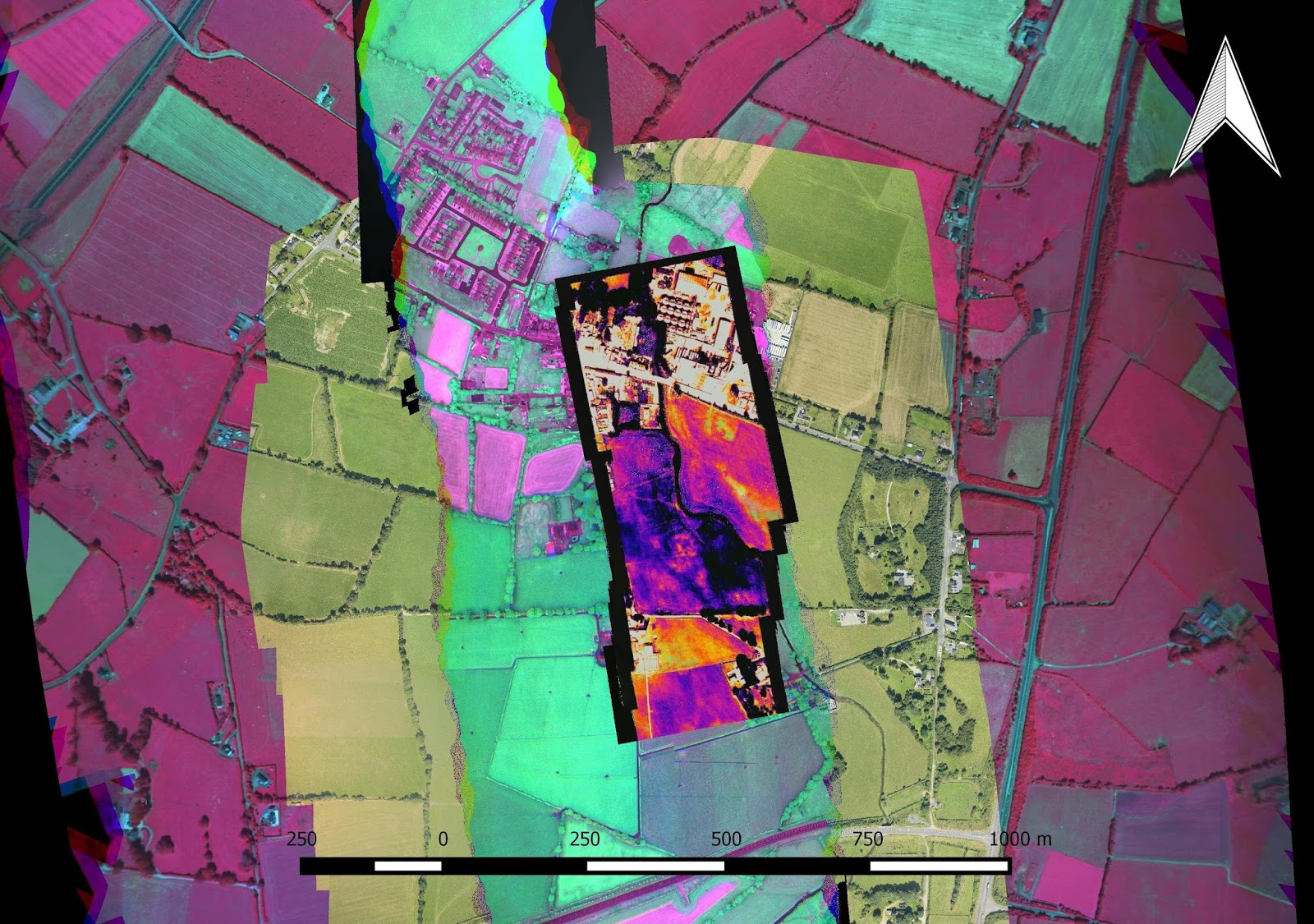
Sensor Pods and Sensor Fusion
Our short paper detailing system concept, design and calibration of the aerial sensor pod is now available online. This research feeds into a number of NCG projects including bathymetry, slick feature mapping, forestry, precision agriculture and infrastructure surveys. The sensor pod captures RGB, HD Video, thermal, multispectral and hyperspectral imagery and is a very rich dataset with multiple applications.
Saturday 4 February 2017
HD ISS Video
The first ISS video I ever watched was probably one of the most impressive things I have ever come across online. But as more and more of them were released, it was unavoidable not to become slightly desensitised to the amazing stuff in each release and just skip through them. This video is one of the most recent and also one of the best I have seen in some time - you really need to watch it in HD if you can, or at least the highest resolution your monitor will allow.
Thursday 2 February 2017
Space Archaeologist
What a great job title!? And another great example of a combination of satellite remote sensing and crowd sourcing to process and analyse data and help document and fight looting of archaeological sites. If you are interested in helping fight the loss of cultural heritage get involved here
....Could I be a Space Surveyor? A Space Cartographer? Earth observation and remote sensing is a bit of a mouthful...what about a Space Spatial Analyst...too far?
Wednesday 1 February 2017
Frost in the shade
Here is a beautiful satellite image brought to my attention by Daire. A Sentinel 2 RGB of the hillocks to the east of Clew bay - interesting landforms at the best of times, but the image taken that cold November morning caught all of the frost that was still present in the shadows of the hillocks. iIsuppose 'satellite image appreciation' is just one of the unexpected benefits of free, 10m imagery.

Subscribe to:
Posts (Atom)
About Me

- Conor
- My name is Conor. I am a Lecturer at the Department of Geography at Maynooth University. These few lines will (hopefully) chart my progress through academia and the world of research.