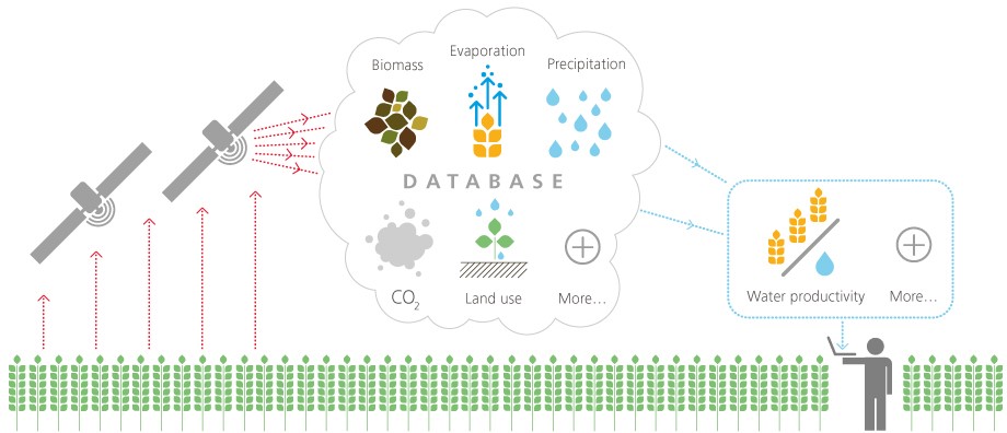
A UN project using satellite data for monitoring and improving water use and management in Africa and the Middle East has gone beta this week. They use real time satellite data (although quote 1 to 10 days as the time delay - so it is more near real time) and Google Earth Engine to do the processing. One to watch and must forward it to a Californian friend of mine who is dipping his toes into Precision Ag. Spatial resolutions of 30m to 250m, so I'm guessing Landsat is the smallest they use?

No comments:
Post a Comment