Its not often I have a geo-related 'Halloween' blogpost - but I came across this movie on Sky movies recently and could not believe my eyes...someone seems to have cast a standard DJI Drone as 'the murderer' in a recent movie. It has everything to shock and horrify a licensed drone pilot - unsafe flying practices, dangerous maneuvers in shared airspace, flying indoors, GDPR violations - it even looks like it weaponises poor battery charging procedures. The thing that will push me over the edge is if they don't back up their data at the end...horrific.
Thursday, 31 October 2019
Wednesday, 30 October 2019
ICESAT 2 and Bathymetry
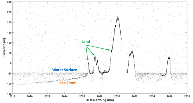
IceSAT 2 was in the news recently - people have been using it to map the seabed/water depths. This is good news - the availability of recently captured calibration datasets (no matter how sparse) is a major impediment to roll-out of satellite derived bathymetry, as the seabed changes so much over time in places and the calibration data should ideally be captured close to the time the image was captured at. Laser wavelength is in the green portion of the spectrum - so good for penetrating water - wonder where they get the surface from? Weaker returns maybe? Tide gauge nearby?
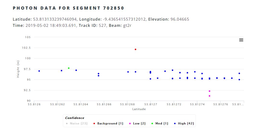
I had a look to see what sort of coverage we had for coastal regions in Ireland and was directed to the excellent openaltimetry website. Looks like we have one scanline running through Tralee bay, another through Dublin bay - both sites we have published papers for but used older calibration data.
If you look closely in the image above - you can see there are points to the left and right of the green scanline - I dont know enough about the system yet to know is the profile spacing actually less (p.s. less is better) than that image suggests, or is that something to do with image footprint (unlikely as it is only 17m according to the website). You can use openaltimetry.org to have a quick look at profiles anywhere in Ireland - wonder would it have picked up the change over the National Ploughing Championships...
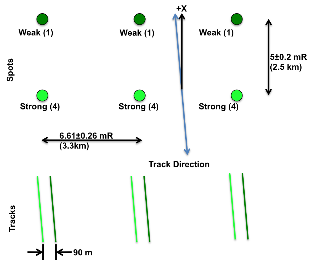
Update: Here's my answer - 6 beams organised in 3 pairs, with a weak/strong combination. Probably also answers the water surface question too..
Tuesday, 22 October 2019
EARSC Market Report
The annual EARSC report is out, summarizing the European Space Industry and Market in 2019. Always an interesting read - I was please to see Ireland moving up the '"Number of Companies" ranking, ahead of number of larger countries, so a great sign that things are moving in the right direction. We will see how the recent launch of the national space strategy effects this.
It certainly should effect it positively, as only yesterday Minister Halligan was in the news announcing some success stories in Irish industry and also a new €500,000 fund to help private industry collaborate with public bodies on space based projects. Very interesting to see ESA will also be partnered with Maynooth University in organizing this fund, so more good news there.
I can certainly see plenty of opportunities for collaborations and know multiple public bodies looking for expertise, the problem is finding the right partners in private industry.
Wednesday, 9 October 2019
ERC - again....
Academia is a funny old fish - three years ago I was tapping away at the weekend on an ERC project proposal, only to be surprised by an early arrival. Three years later at that 'early arrivals' 3rd birthday party I'm busy revising that proposal for resubmission. Lots changed in those three years, mostly my knowledge of Thomas the Tank Engine and Dinosaurs.
Update: ok - submitted. Now to deal with the massive backlog that has accumulated!
Thursday, 26 September 2019
Our new eBee RTK - a donation from KOREC
We had Helen Gilmartin from Korec onsite earlier in the week. Immediately after greeting the new cohort for the MSc in GIS/Remote Sensing we went outside to use the lovely autumn colours (and the new MSc cohort) as a backdrop for the photo of a drone handover. Korec very generously donated a fixed wing RTK drone - the eBEee RTK to the department and this hardware going to be really important for lectures and research in the coming years.
![]() |
| The students... |
![]() |
| And the lovely colours... |
Monday, 23 September 2019
Sentinel in the news again
There are very few days go by that satellite data or remote sensing is not mentioned in the news. You might need to look hard at the article as its often just a brief mention - supporting some other big announcement - but is usually the key enabling technology. Glaciers retreating, forest fires in the amazon, some unfortunate animal under threat - but inevitably you will see 'satellite data' mentioned, either one of the big free datasets like Copernicus or Landsat, or some of the high resolution vendors like Digitalglobe.
The latest in the Irish media is a reference to Ireland's need of a good land cover/land use map, as we have been making do with CORINE to date with according issues relating to accuracy, resolution, class type,etc. The good news is that there is a collaboration between the EPA, Teagasc, OSi and others underway to develop new landuse datasets to fill this hole - using OSi high resolution multiband aerial images and combining these with the high temporalresolution of the Sentinel satellites. I've been involved on some land cover mapping with OSi on the change detection project, and when presenting this work at IEOS2019 in Teagasc before christmas the previous speakers were the EPA/Osi and the new datasets look great. Watch this space as land use maps will feed into pretty much every monitoring or assessment task you can imagine. Accurate, regularly updated land use maps (that's where the satellites come in) can predict and prevent pollution, flooding, effects caused by climate change, urban sprawl, poor agricultural practices, you name it.
And keep an eye out for space data in the news - it is there almost every day.
Tuesday, 17 September 2019
Paper Published: Remote Sensing of Environment
The GSI shortcall in 2015 gave us the opportunity to look at ways of applying bathymetric derivation algorithms to high resolution imagery. We looked at RapidEye (5m), Pleiades (2m), light aircraft and drones (sub-decimetre). The project focussed primarily on the airborne and drones (report available here) but gave us valuable insights on what we needed to take the algorithms and begin to adapt them for satellite data provided through ESA TPM license. We were then able to advance the work begun with the Dublin bay bathymetry paper and look at applying spatial and non-spatial models to improve accuracy of satellite derived bathymetry (spoiler - helps as depth increases). This was a multi partner project - I've been working on it over the 4 years and includes NCG, Rothamstead Research,Geological Survey and industry. Great to see it finally published in such a good journal.
Available to download via open access here
Subscribe to:
Posts (Atom)
About Me
- Conor
- My name is Conor. I am a Lecturer at the Department of Geography at Maynooth University. These few lines will (hopefully) chart my progress through academia and the world of research.