2019 was another good year.
Work on the OSi project coming to a successful conclusion, 3 journal papers published (one with Remote Sensing of Environment), 2 surveyors journal articles published, 2 EO sessions at EUGEO, a SFI Discover award, through to last stages of SFI Frontiers, managed to get an ERC proposal submitted, co-developing the new INFOMAR module, collaborated on national space strategy - and sponsorship of a eBee drone from KOREC!
Think that's it - time to enjoy the holiday.
Tuesday, 31 December 2019

Friday, 20 December 2019
SFI Discover - Space, Surveyors and Students: STEM and Sustainable Development Goals (5*S)
Very pleased to hear that our SFI Discover proposal was successful - Space, Surveyors and Students: STEM and Sustainable Development Goals (5*S)

5*S builds on two existing national school-based programmes to target a national audience. A collaboration between Esri Ireland’s award-winning, ‘ArcGIS for Schools’ programme and the Society of Chartered Surveyors ‘Day in the Life’ recruitment programme offers the opportunity to combine a national network of volunteers with an existing data and training infrastructure in Irish primary and post-primary schools. Added to that 5*S was awarded funding for a software developer to work on AR and bring Copernicus into the schools.
Project partners are Maynooth Geog, Maynooth Dept Education, TU Dublin, Esri Ireland, Society of Chartered Surveyors Ireland and Ordnance Survey Ireland - collaborating with ESERO/SFI.
We'll have more info in 2020 and announce it properly but here's the Silicon Republic article
Saturday, 30 November 2019
New Paper: Spatially Optimised
Glimpse getting another outing with a recent LiDAR/point cloud paper in the Journal of Spatial Science with a few NCG alumni. Dr. Pankaj Kumar (now in Uni of South Australia) lead author.

Spatially optimised retrieval of 3D point cloud data from a geospatial
database for road median extraction

Thursday, 31 October 2019
"The Drone" - A Post for Halloween....
Its not often I have a geo-related 'Halloween' blogpost - but I came across this movie on Sky movies recently and could not believe my eyes...someone seems to have cast a standard DJI Drone as 'the murderer' in a recent movie. It has everything to shock and horrify a licensed drone pilot - unsafe flying practices, dangerous maneuvers in shared airspace, flying indoors, GDPR violations - it even looks like it weaponises poor battery charging procedures. The thing that will push me over the edge is if they don't back up their data at the end...horrific.

Wednesday, 30 October 2019
ICESAT 2 and Bathymetry
IceSAT 2 was in the news recently - people have been using it to map the seabed/water depths. This is good news - the availability of recently captured calibration datasets (no matter how sparse) is a major impediment to roll-out of satellite derived bathymetry, as the seabed changes so much over time in places and the calibration data should ideally be captured close to the time the image was captured at. Laser wavelength is in the green portion of the spectrum - so good for penetrating water - wonder where they get the surface from? Weaker returns maybe? Tide gauge nearby?
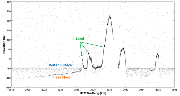
I had a look to see what sort of coverage we had for coastal regions in Ireland and was directed to the excellent openaltimetry website. Looks like we have one scanline running through Tralee bay, another through Dublin bay - both sites we have published papers for but used older calibration data.

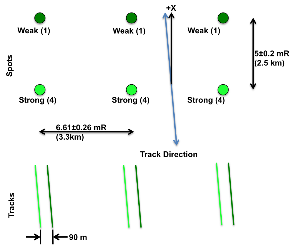
If you look closely in the image above - you can see there are points to the left and right of the green scanline - I dont know enough about the system yet to know is the profile spacing actually less (p.s. less is better) than that image suggests, or is that something to do with image footprint (unlikely as it is only 17m according to the website). You can use openaltimetry.org to have a quick look at profiles anywhere in Ireland - wonder would it have picked up the change over the National Ploughing Championships...
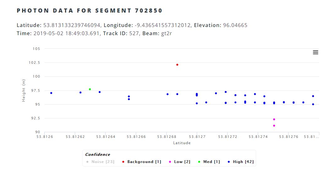
Update: Here's my answer - 6 beams organised in 3 pairs, with a weak/strong combination. Probably also answers the water surface question too..
Tuesday, 22 October 2019
EARSC Market Report
The annual EARSC report is out, summarizing the European Space Industry and Market in 2019. Always an interesting read - I was please to see Ireland moving up the '"Number of Companies" ranking, ahead of number of larger countries, so a great sign that things are moving in the right direction. We will see how the recent launch of the national space strategy effects this.

It certainly should effect it positively, as only yesterday Minister Halligan was in the news announcing some success stories in Irish industry and also a new €500,000 fund to help private industry collaborate with public bodies on space based projects. Very interesting to see ESA will also be partnered with Maynooth University in organizing this fund, so more good news there.

I can certainly see plenty of opportunities for collaborations and know multiple public bodies looking for expertise, the problem is finding the right partners in private industry.
Wednesday, 9 October 2019
ERC - again....
Academia is a funny old fish - three years ago I was tapping away at the weekend on an ERC project proposal, only to be surprised by an early arrival. Three years later at that 'early arrivals' 3rd birthday party I'm busy revising that proposal for resubmission. Lots changed in those three years, mostly my knowledge of Thomas the Tank Engine and Dinosaurs.
Update: ok - submitted. Now to deal with the massive backlog that has accumulated!
Update: ok - submitted. Now to deal with the massive backlog that has accumulated!
Subscribe to:
Posts (Atom)
About Me

- Conor
- My name is Conor. I am a Lecturer at the Department of Geography at Maynooth University. These few lines will (hopefully) chart my progress through academia and the world of research.